

Rounds of showers & storms highlight the weekend
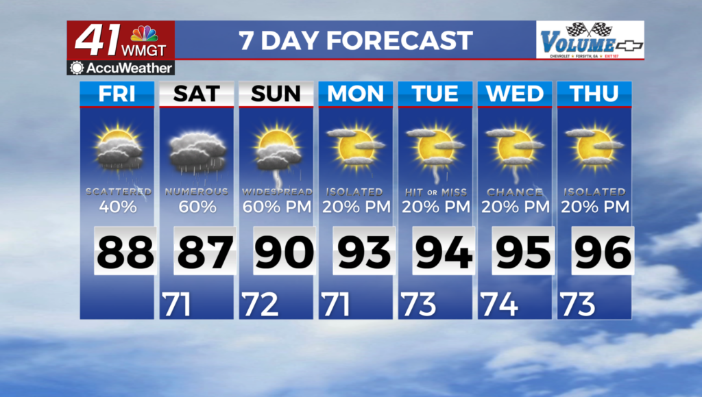
MACON, Georgia (41NBC/WMGT) – As we get into Friday, the current boundary over the coverage area shifts southward as weak cyclogenesis concentrates moisture further towards the Gulf. 


This southward shift, combined with the incoming shortwave and secondary front, has resulted in a decrease in the excessive rainfall risk from previous days. We still have a marginal risk (level 1 of 4) for excessive rainfall, which will likely be focused near wherever the current boundary sets up tomorrow. Isolated pockets of 3 inches or more from individual slow moving thunderstorms may be possible. With the southward shift, this is more likely to occur south of the fall line where soils can more readily handle heavy rainfall. Temperature wise, the increased cloud cover over the 


coming days along with the incoming cooler air will provide some temporary heat relief (relatively speaking) into the weekend. The long term forecast begins as the longwave upper-level trough retreats towards the northeast, leaving the region in a general ridging pattern through the extended period. This will reinvigorate our summertime conditions, with high temperatures climbing back into the low to mid 90s for most of our coverage area by midweek. These rising temperatures, combined with an ongoing influx of low-level moisture from the Gulf, will keep dewpoint temperatures in the low to mid 70s making it feel downright unpleasant during the afternoons. For the time being, this combination will remain below the Heat Advisory criteria. This pattern will provide the diurnally driven isolated to scattered thunderstorms each day. However, the prospect of severe weather remains low in the absence of noteworthy shear or more supportive dynamics. Regardless, daily afternoon instability will provide the potential for a few strong storms to briefly become severe, with strong gusty winds, frequent lightning, and heavy rainfall. The bottom line is to expect more of the same August weather, with no real change in the pattern through at least the end of next week.