


Remnants of Beta bring rain and humidity to Middle Georgia
Clouds have increased across the southeast today as what is left of Tropical Storm Beta slowly moves east.
At this point Beta has essentially become a low pressure system with a cold and warm front. The warm front sector will be moving through our area tomorrow afternoon, introducing rain chances back to the forecast as well as increasing our humidity.
Rain chances will mostly begin Thursday afternoon with just a few showers possible.
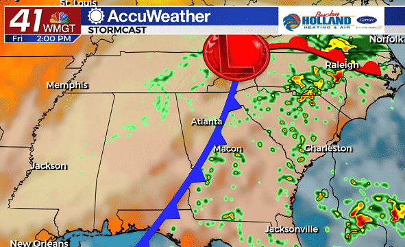
Rain and storm chances will start increasing through the day on Friday, as the cold front portion of the storm begins to move through.
I am not expecting widespread severe weather, but we can’t rule out a few storms becoming strong Friday afternoon. 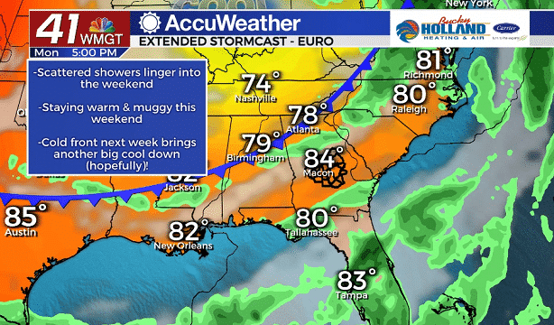
The cold front will be stalling and falling apart over Middle Georgia through the weekend and hence, we are going to keep rain chances through Sunday. No day will be a total rain out, but showers and storms will be possible as humidity stays relatively high.
Starting next week a cold front will push through either Sunday or Monday, and bring a small chance of rain. Behind the front cool air moves back into Middle Georgia

Highs for next week will be cooling down through the middle of the week, with dry air following behind. Highs will be limited to the 70’s and lows will once again fall into the 50’s.
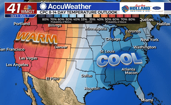
Looking ahead to the start of October, things will be cooling off big time! There are still some questions as far as how much, but most models are signaling a big temperature swing.
Leave a Reply