Record warmth for Christmas
MACON, Georgia (41NBC/WMGT) – The big story of interest in the forecast through Christmas Eve and beyond will be the unusual warmth. Low temperatures will be in the 50s, meaning 


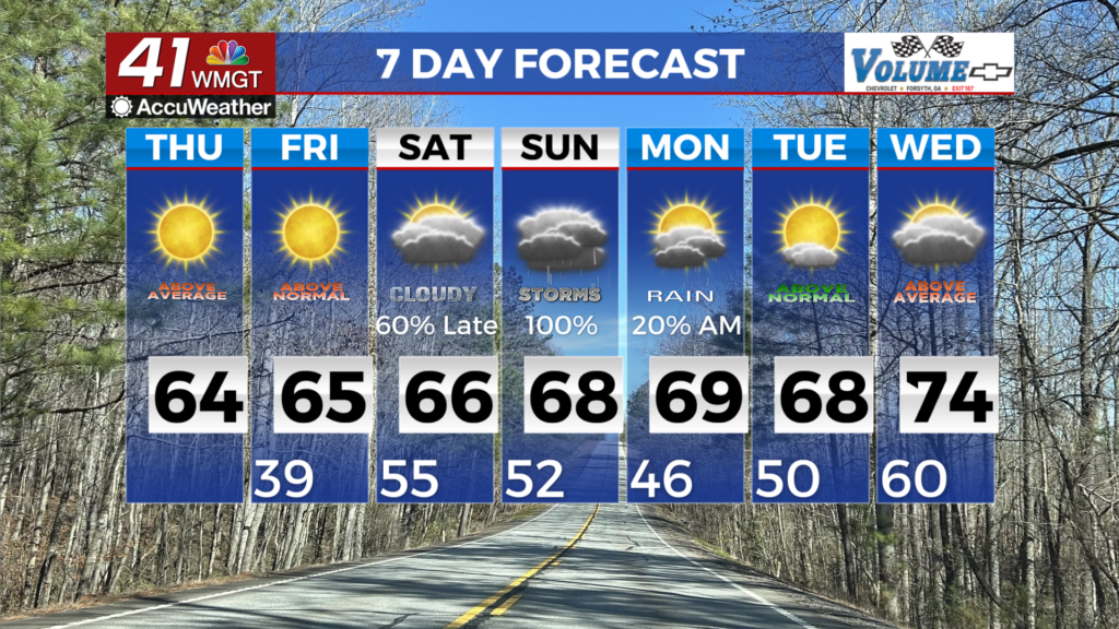
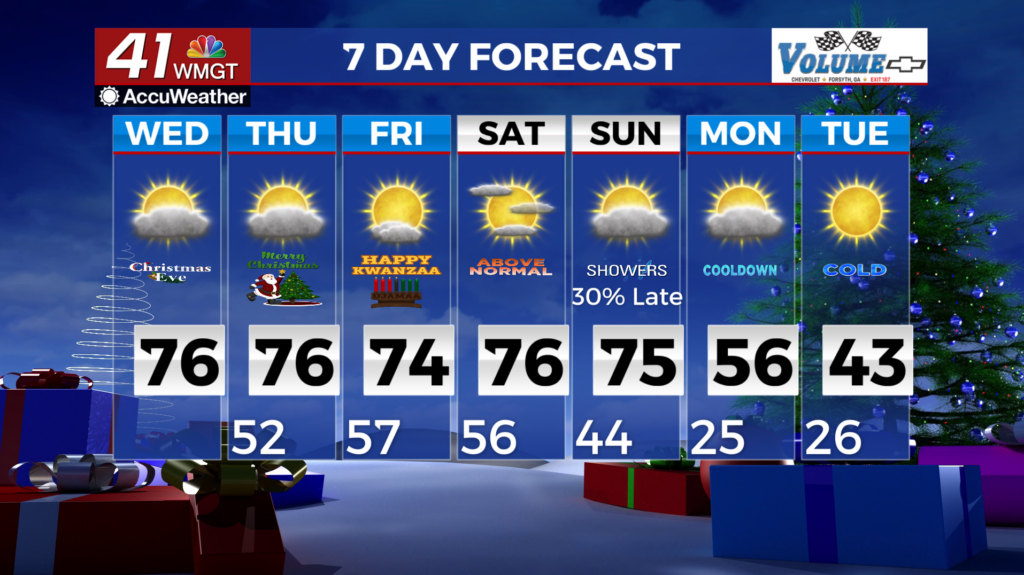
 that most the region will start off Christmas Eve with temperatures that are already close to average high temperatures. Westerly winds will bring warm air advection during the day and by the time the afternoon arrives, 70 degree temperatures will be widespread. We expect a number of locations to either tie or break records. The primary bust factor in the forecast is cloud cover. The more clouds, then the forecast would reduce the potential for record highs, while fewer clouds would increase the potential for multiple records to fall. Some patchy dense fog is possible tonight south of Columbus, but in general the westerly flow should keep the needed Gulf moisture focused over south Georgia. Impacts are possible for anyone traveling to southern Georgia tomorrow morning. The long term period picks up on Christmas Day with continued warm temperatures across the region. A broad ridge over the Great Plains advances towards the eastern U.S. while surface high pressure moves across the northern Gulf coast. This high pressure regime will keep unseasonably warm temperatures in place into the weekend. Lows on Christmas morning will largely start out in the low to mid 50s across north and Middle Georgia. Aside from highs in the mid to upper 60s in the highest elevations, highs will then rise into the mid to upper 70s in the afternoon. These high temperatures will be 15-23 degrees above daily normal temps. These numbers will remain fairly consistent through at least Saturday. Late Friday into Saturday, a shortwave and associated surface low moves across the Ohio Valley region, which could spread isolated to scattered light showers into portions of far north Georgia, although rainfall amounts are expected to be extremely light.