Rain & thunderstorm chances increase by week’s end
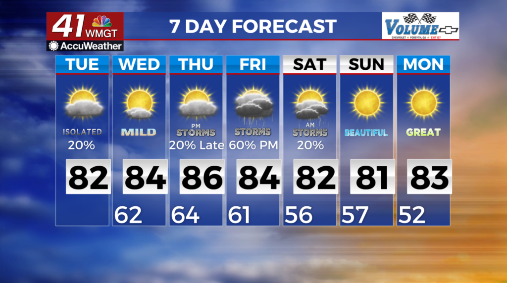
MACON, Georgia (41NBC/WMGT) – A stalled front across southern Georgia will be the lift source for some thunderstorms later today as temperatures heat up. Some storms may have 
 gusty winds and small hail. A wedge has developed along the spine of the Appalachians. This has limited our temperatures and clouds. As the winds shift southeast, this wedge will weaken bringing the potential for pulse convection in the afternoon. Starting Wednesday, the subtropical ridge will set up in the southern Great Plains. Daytime driven isolated to scattered pop-up showers can be expected across the region with plenty of daytime heating and copious amounts of moisture in place. As this wave moves by the region on Thursday to our northwest, rain and convection may develop to the west of Georgia. By Friday, a larger wave digs from the north that should drive a front towards the area, bringing thunderstorm chances during the afternoon and into the overnight. That front slowly pushes through the area Friday night into Saturday, allowing for some potential storms in east Middle Georgia on Saturday depending upon the speed of the front.