
Rain and storms linger overnight, but much of Tuesday should be dry
Rain and storms are still hanging around Middle Georgia this evening. You can expect to see a few more storms ahead of a cold front moving through by tomorrow morning.
Through the day on Tuesday we will see some clearing as drier air moves in behind the front.
Not only that, the front will bring some cooler high temperatures for much of the rest of the week. Expect highs to top out in the low 80’s and upper 70’s.
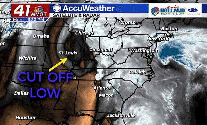
An area of low pressure to our north will get pushed down into the southeast, bringing us scattered shower and thunderstorm chances through much of the rest of the week.
There are still a few questions about where the cut off low will move and our rain and storm chances will be entirely dependent on the placement of that low.
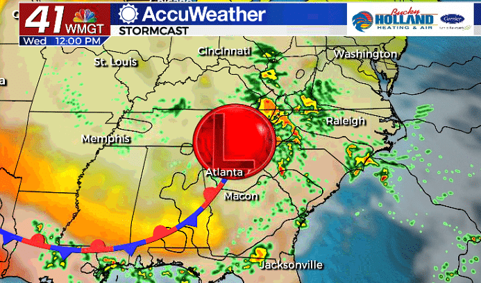
As the low moves further south, a stationary boundary will set up and act as the axis for storms to form. Severe weather is not expected through this week, but we could see a few heavy downpours.
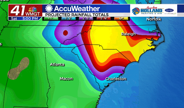
Although we will most likely miss out on some of the heaviest rain, some places could pick up an isolated 1″ of rain by the weekend.
The heaviest rain is likely to set up in the Carolinas with some places picking up over 5″ of rain in the next 4 days.
Once again, placement of the low further to the west, could bring the heaviest rain closer to our area, so it will be something to monitor through the next few days.


Leave a Reply