
More rain and slightly cooler temps move in for the week
Rain and storms once again popped up across Middle Georgia today bringing some gusty winds, heavy rain and frequent lightning.
This is just the beginning of what will likely be a rainy week and weekend.
Tomorrow we will start our day like we have the past few, with patchy fog, a quick warm up, and high humidity.
By the afternoon we will likely see more pop up showers and storms all of which bring the possibility of heavy rain, lightning, and gusty winds.
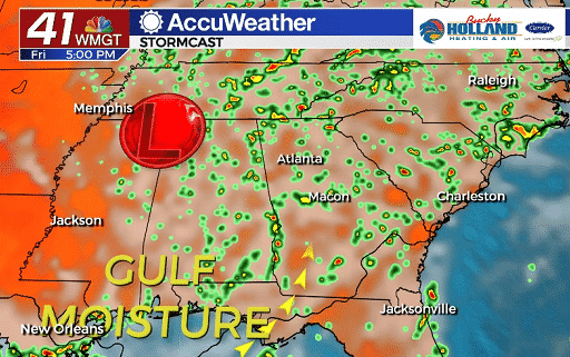
Each day this week will bring the same threat thanks to a slow moving area of low pressure and gulf moisture.
As the low gets closer, our rain chances will begin to get higher and so will our instability. This will bring a chance of strong storms even through the weekend.
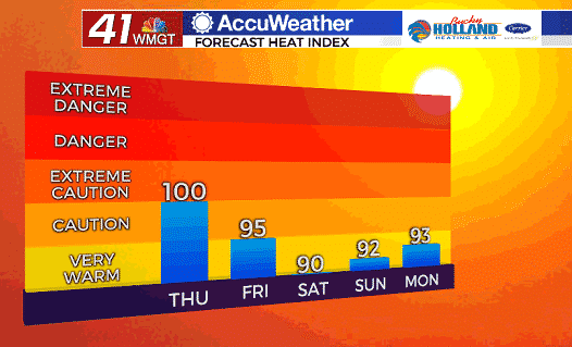
As storms continue, our high temps will start to fall, and with those, our heat index values.
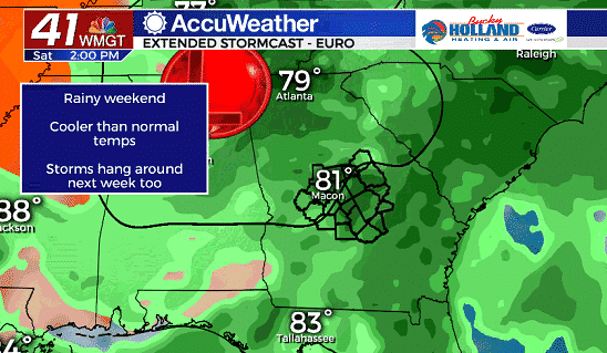
By Saturday, expect off and on rain through the day. Some spots could see tropical downpours as well as strong thunderstorms.
The all day rain will be moving out by Sunday as the center of low pressure also begins to move out.
Rain totals between now and Sunday will likely add up to an additional 1-3″.


Leave a Reply