


Rain returns to the forecast to end the week
Sunshine was abundant today, and I really hope you got to enjoy it, because clouds will be moving in overnight.
A wedge front will be setting up to our east, keeping the clouds in the area through the day Wednesday.
Scattered showers will be possible through the day tomorrow, but we are not expecting any thunderstorms.
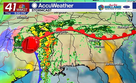
On New Year’s Eve a low pressure system will approach the southeast.
This will bring us a chance of thunderstorms during the afternoon/evening hours for New Year’s Eve, but I don’t think we will see the severe threat until New Year’s Day.
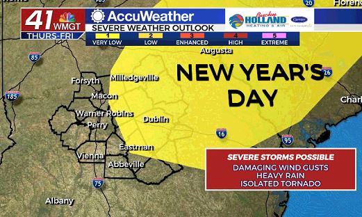
The above graphic is from the Storm Prediction Center, showing the area that has be best chance for strong/severe storms on Friday.
Main threats will be damaging wind gusts, isolated tornadoes, and heavy rain.
Timing for severe weather is still up in the air, but I would expect it to be during the afternoon and into the early evening hours on Friday.
Have multiple ways to get your warnings on Friday…highly recommend the 41NBC Accuweather app.
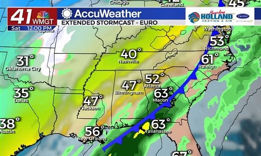
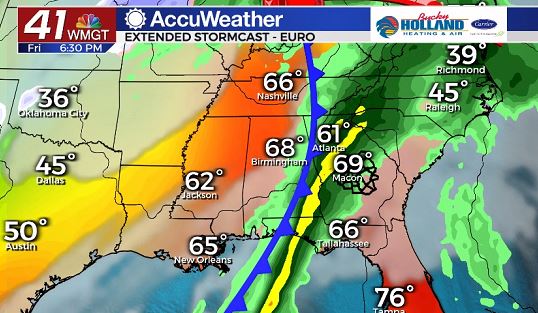
Saturday the rain will be sticking around, but any severe threat will have moved out.
Temps on Saturday will be staying mild, before everything starts to cool off Sunday.
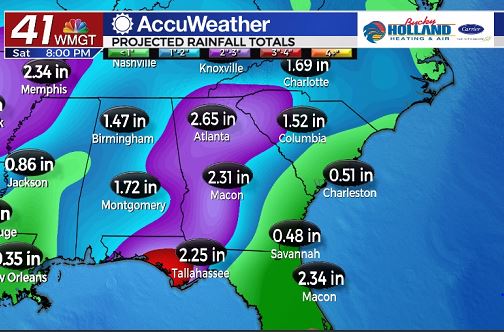
Heavy rain through the end of the week will end up totaling to 1-2″, with some people seeing locally higher totals.
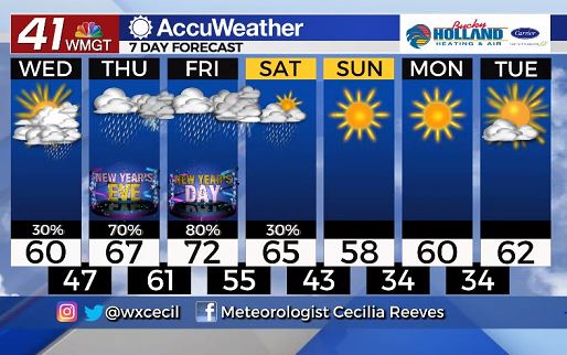
By Sunday, although it will be cooling down, we will finally start to dry out.
High pressure will be sticking around for much of next week, which means dry conditions and a slow warming trend.

Leave a Reply