


Rain returns after dry stretch
MACON, Georgia. (41NBC/WMGT)- Isolated showers today will give way to better organization of showers and storms over the next few days.
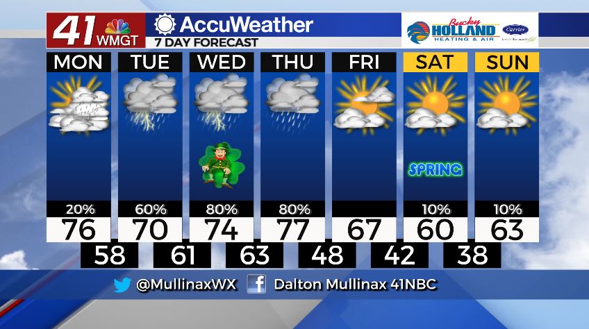
TODAY.
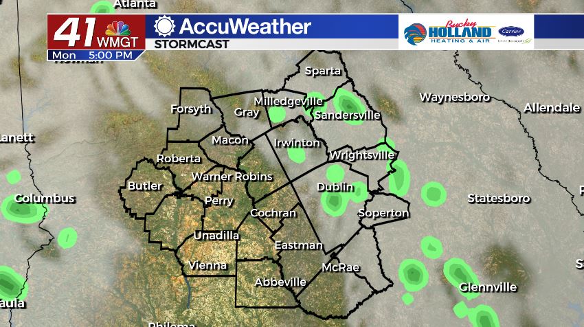
Under a partly sunny sky high temperatures will climb into the middle 70’s. Rain showers will move back into the forecast area as well. Shower coverage will be isolated this afternoon and throughout the nighttime hours. Expect overnight lows to fall into the upper 50’s under a cloudy sky.
TOMORROW.
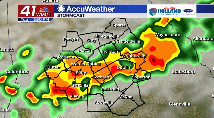
Cloudy conditions tomorrow will keep temperatures in the upper 60’s and lower 70’s. There is the chance for a few strong storms mainly during the afternoon. The main storm threats would be damaging wind gusts. We will keep a close eye on this threat.
WEEK AHEAD.
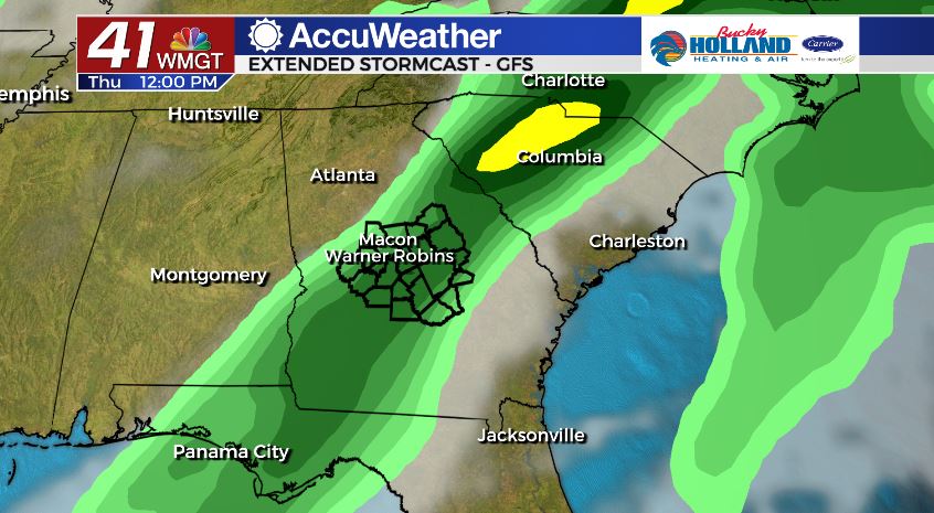
A greater threat for strong to potentially severe storms looks to move in Wednesday evening and into the day on Thursday. A dynamic storm system moving across the southeast looks to bring an increased threat for severe weather to Middle Georgia. All modes of severe weather look to be in play at this time (tornadoes, damaging winds, heavy rain, frequent lightning). The timing is still being ironed out so stay with the 41NBC Accuweather forecast team for the latest.
Follow Meteorologist Dalton Mullinax on Facebook (Dalton Mullinax 41NBC) and Twitter (@MullinaxWX) for weather updates throughout the day. You can also watch his forecasts Monday through Friday on 41NBC News at Daybreak (6-7 a.m.) and 41Today (11 a.m).

Leave a Reply