

Rain leads to much colder temps for next week
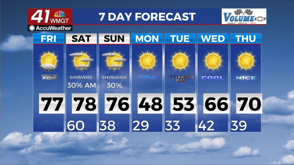
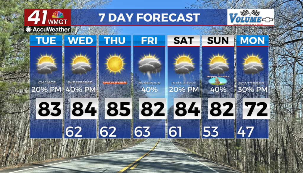
MACON, Georgia (41NBC/WMGT) – Clear and warm conditions through Friday afternoon as zonal to weak ridging moves across the area. High temps rise above normal to the 70s to near 80s 


 in Middle Georgia. Moisture will increase as the atmosphere begins to destabilize. Going into Friday night, the shortwave energy begins to move across the Southeast, driving an initial cold front through the area, before the main cool off early next week. No significant temperature changes with this, however, this will start widespread showers and a few isolated thunderstorms across North Georgia. Middle Georgia could also see some showers, although this will likely occur around the Saturday timeframe. Thunderstorm conditions will be marginal. Strong southwesterly flow will destabilize conditions directly ahead of the front. The main threat for Northwest Georgia will come with any cells that manage to hold together from out west rather than any newly triggered convection. For Middle Georgia going into Saturday morning, convection could trigger later along the front itself or on any remnant outflow systems from earlier convection to the northwest outrunning the front. An active start to the long term forecast as Saturday afternoon will be on the tail end of the first cold front and will be preparing for the second push of impactful weather. The second round looks to push into North Georgia overnight Saturday into Sunday morning as we see a push of moisture in and along the trough over the Central and Eastern U.S. Rain chances should be higher towards the morning hours Sunday. The Storm Prediction Center current has our area under a Marginal Risk at this time, however, instability remains low. As this system pushes out of the area, all eyes will shift to how cold our area will get. High temps for Monday are expected to top out in the mid 30s to mid 40s across much of the area. Monday night the entire viewing area is forecast to be below freezing.