
Rain later this morning, then a brief cooldown for Friday
MACON, Georgia (41NBC/WMGT) – Satellite imagery shows moisture streaming northeastward ahead of a southern stream shortwave along the Gulf Coast. This is overtop of a still relatively 


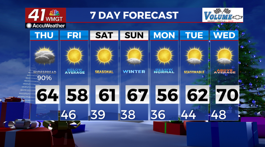
 cool area of high pressure along the East Coast. As this shortwave moves east-northeastward across Alabama today, expect widespread light to moderate rain to develop later this morning and continue into the afternoon. Rainfall and cloud cover will keep high temperatures in check, however, they will still be a little above normal. The precipitation should also limit destabilization and thunder potential this afternoon. Meanwhile in the northern stream a vigorous trough moves eastward across the central and eastern U.S. today and tonight, along with a strong surface low over Lake Superior. This will send a cold front through the state tonight. Cooling aloft will contribute to some weak elevated instability developing, but the daytime precipitation should preclude any surface-based instability. Therefore, a weakening broken line of convection is expected along the front. While some gusty winds may occur with frontal passage, severe storms are not expected. Between the two waves of precipitation, the only meaningful chances of greater than 1 inch of rain will be in the North Georgia counties and also in the far southeast counties near a potential cluster of storms moving out of the Gulf. Cooler and breezy conditions are expected Friday behind the front.