Rain is gone, cooler temps on the way
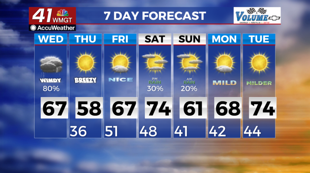
MACON, Georgia (41NBC/WMGT) – The current line of showers and thunderstorms arrived Wednesday morning and has since pushed eastward.
A Wind Advisory remains in place through 7 p.m. Wednesday.
East to southeast winds have increased across the area ahead of the front and the wind gradient will continue to tighten across the area ahead of this system.
Models continue to show a minimal amount of instability ahead of the front. However, there is still quite a bit of dynamic energy associated with the system. We have the interaction of the jet stream that’s positioned over the area, small amount of instability and wind, heavy showers and thunderstorms. All of this may mix these winds down to the surface.
An isolated brief tornado is not out of the question given these factors.
Shower and thunderstorm activity will mostly shift east of the area by midday Wednesday, but some wraparound showers will dip across North Georgia during the afternoon.
Cooler temperatures will begin to filter into the area behind the cold front, with lows in the mid 30s.