

Rain chances return tomorrow
High pressure returned to Middle Georgia today, bringing dry weather and some cool temperatures.
Through the day tomorrow a warm front will be pushing north from Florida, bringing in moisture and warm weather.
A few showers will be possible tomorrow afternoon as well as a thunderstorm, but severe weather is not expected.
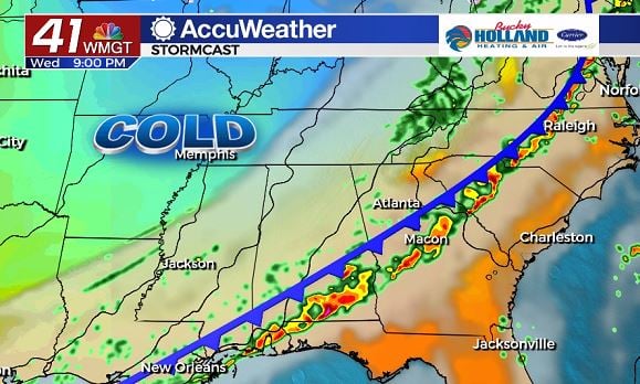
By Wednesday a cold front will be approaching the area and bringing a chance for storms by Wednesday afternoon.
Because of the timing of this front, we will have to keep a close eye on the potential for instability that could lead to strong thunderstorms.
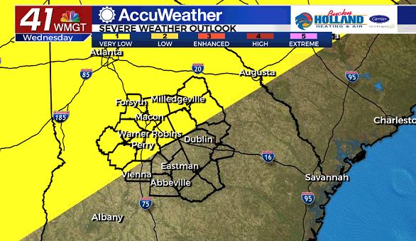
The Storm Prediction Center has issued a level 1 threat for Wednesday and it generally looks like a pretty low severe threat.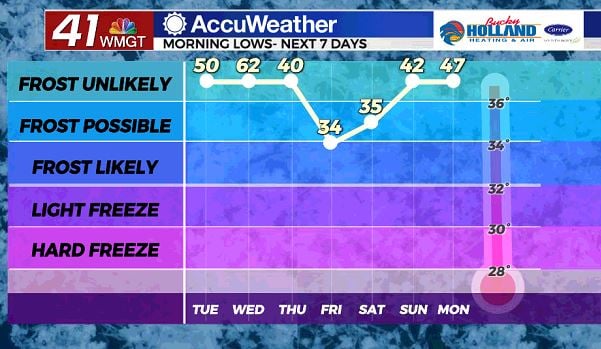
Behind the cold front, our weather will start to dry out and cool down.
Friday and Saturday morning temperatures will be dropping into the low 30’s, with some places seeing frost and potential freezing conditions.
Be sure to take care of any sensitive plants that you may have already planted.
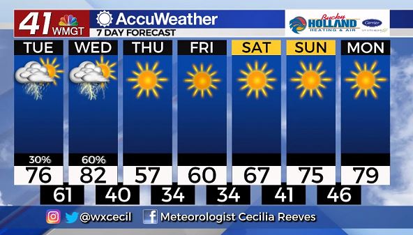
The end of the week will be clear and cold with highs being limited to the 50’s and 60’s.
Sunshine will be hanging around for much of the extended forecast, so there are no weather worries for Easter weekend.
We will also be seeing a considerable warm up through the weekend that will be warming us back to the mid 70’s by Easter.


Leave a Reply