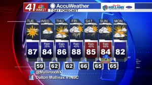
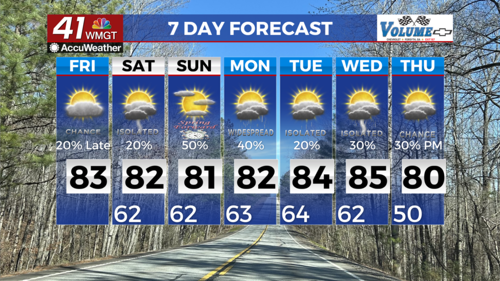
Rain chances increasing over next several days
MACON, Georgia. (41NBC/WMGT) – Somewhat drier air hangs around today, but showers return tomorrow and last through the weekend.
TODAY.
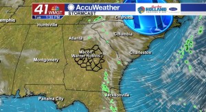
After a gorgeous Monday afternoon across Middle Georgia, we will see another nice day today. Temperatures this afternoon will top out in the middle to upper 80’s under a mostly sunny sky. A high pressure center in the Carolinas will keep us dry this afternoon, but as that high pressure center shifts further to the northeast we will see a little bit more moisture flowing in off of the Atlantic Ocean. Overnight tonight temperatures will bottom out in the upper 50’s and lower 60’s under a mostly clear sky.
TOMORROW.
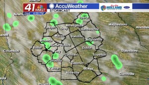
Rain chances are on the rise beginning tomorrow. With an easterly to southeasterly flow bringing in more moisture to our area, we will be able to squeeze out a few isolated showers tomorrow. Under a partly sunny sky temperatures during the afternoon will top out in the middle 80’s while overnight temperatures will fall into the middle 60’s under a partly cloudy sky.
EXTENDED FORECAST.
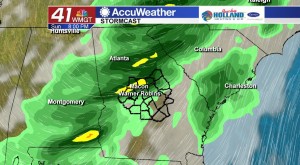
An unsettled weather pattern is going to set up across Middle Georgia beginning late on Thursday and that will allow for rounds of rain as we head into the weekend. A cold front approaching out of the Central Plains will flatten out in an east to west orientation and begin to stall out in the north Georgia mountains. Along this front is where waves of energy will propagate and bring showers and thunderstorms to Middle Georgia. Another cold front will move through later on Sunday and will clear us out as we head into the next work week.
 Follow Meteorologist Dalton Mullinax on Facebook (Dalton Mullinax 41NBC) and Twitter (@MullinaxWX) for weather updates throughout the day. You can also watch his forecasts Monday through Friday on 41NBC News at Daybreak (5-7 a.m.) and 41Today (11 a.m.).


Leave a Reply