
Rain chances decrease for Thursday, go up for Friday
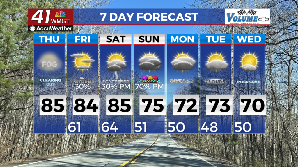
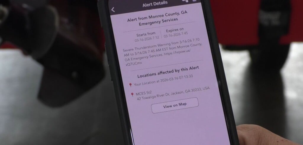
MACON, Georgia (41NBC/WMGT) – Areas that received rainfall yesterday, will likely be subjected to an increased chance for low clouds and fog this morning. Unseasonably warm temperatures 


are expected through Saturday. Highs mainly in the lower to middle 80s with lows in the lower 60s. As we close out the work week, temperatures will surge as the flow out ahead of the next front turns to the southeast. Daytime highs on Friday and Saturday will rise into the low to mid 80s across the region with dewpoints in the low to mid 60s. This is about 10 to 15 degrees above what we would expect to see this time of the year. This summer-like pattern will continue to fuel afternoon convection, with isolated to scattered thunderstorms forming after 2 pm. A cold front on Saturday night into Sunday morning sweeps through and brings conditions more in line with what we would expect to see in April. Given the fronts timing and lack of upper level dynamics we aren’t expecting much in the way of severe weather. A few storms are possible that could have some gusty winds and frequent lightning. Models are continuing to back off of expected rainfall totals, but as of now the potential is 1.5 inches across the coverage area with isolated higher amounts possible. This is unlikely to break our drought conditions, but anything is better than nothing at this point. After the front moves through, dry conditions will set up again for the beginning of next week. Temperatures will fall back into the 60s and 70s and it will feel less humid.