Potential for heavy rain will lead to cooler temperatures
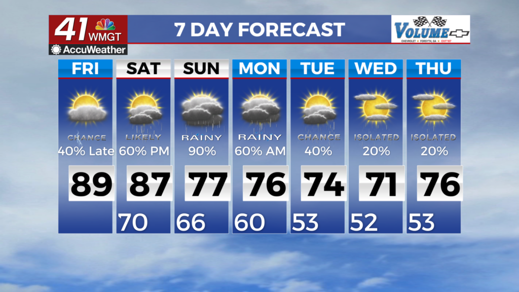
MACON, Georgia (41NBC/WMGT) – Over the course of the next day, the presiding mid-level ridging that has supported our extended period of tranquil, unseasonably warm weather will be 


nudged offshore by an approaching shortwave/surface front duo. As it does so, moisture will rebound, with dewpoints surging back into the 70s by Friday afternoon. In the meantime, this morning’s fog will give way to another day of partly sunny and dry conditions, with highs rising into the upper 80s to lower 90s. We cannot rule out an isolated shower or thunderstorm developing across far southern/southeastern tier this afternoon, but expect a dry day for most. Chances for showers and thunderstorms will increase across portions of Middle Georgia ahead of the approaching front, tomorrow afternoon and evening. Rain rates could be heavy at times. Conditions will be warmer still on the final day of moderation of this airmass, near 90 for most. A marked 


increase in moisture is expected Saturday through Monday, with potential for heavy rainfall and localized flash flooding. Much uncertainty remains regarding where the heaviest rainfall and flash flooding risk will be most likely, due to factors including the strength of a cold air damming wedge and how far north moisture advection is maximized. Severe weather is very unlikely given a pattern that limits instability. The strength of high pressure over the Northeast and Southeastern Canada will largely govern the strength of the resulting Cold Air Damming wedge across the southern Appalachians. The global models struggle to resolve the wedge and have a tendency to underestimate the strength and erode it too quickly. Where exactly the wedge is situated will have an impact on rainfall totals, as the boundary of the CAD airmass acts as a front and may ramp up shower/storm development, intensity, and longevity. Assuming there is a resemblance of a wedge, increased clouds, rain, high temperatures on Sunday and Monday should be capped in the 70s and lower 80s. A more expansive high pressure system spreads across much of the Eastern U.S. Tuesday and Wednesday, shunting moisture southward.