One more cold start before a nice warm-up
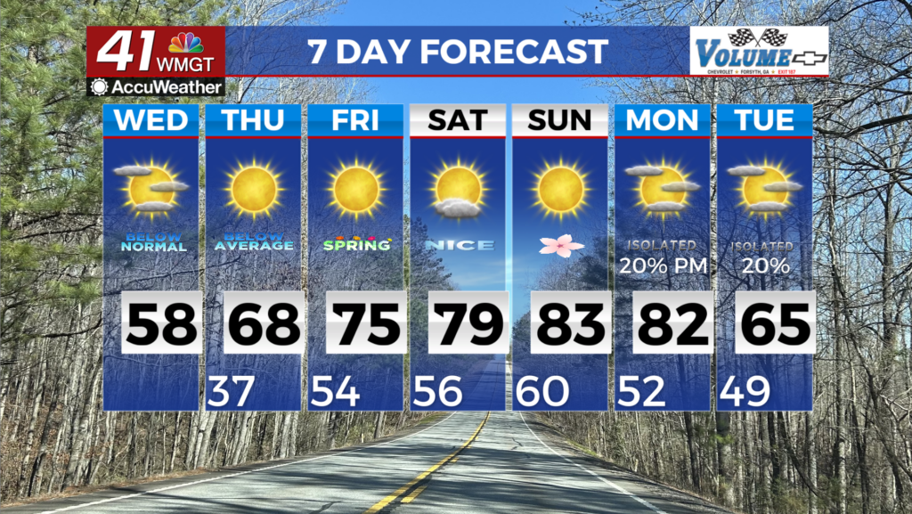
MACON, Georgia (41NBC/WMGT) – We are under a Freeze Warning until 10 AM. We will see some increased cloud cover across the area today as wrap around moisture from the low center 


over the Mid-Atlantic states moves off the eastern seaboard. Not expecting any precipitation only overcast skies through Wednesday night. Temperatures tonight expected to fall into the upper 30s while highs today will get into the upper 50s. The extended forecast starts off cool as the upper level ridge moves out of the area through the late week. Lows remain in the 30s and 40s, however, northwest flow will keep us dry through the period. A few models want to bring quick shots of showers that only really develop with the help of elevation. With that being said, some light rain could develop for far north Georgia and maybe a few flurries for the highest of elevations on Thursday night. No impacts are expected at this time. Temperatures will warm through the late week and weekend as the massive upper level ridge over the western U.S. moves eastward. High temperatures will climb back to the 70s by Friday and may see a return to the 80s by Saturday and Sunday. Low end possibilities of precipitation return to the northeastern coverage area next Monday with a quick shortwave diving down the downstream side of the ridge, however moisture will be limited for this to develop.