


Numerous showers & thunderstorms impact weekend
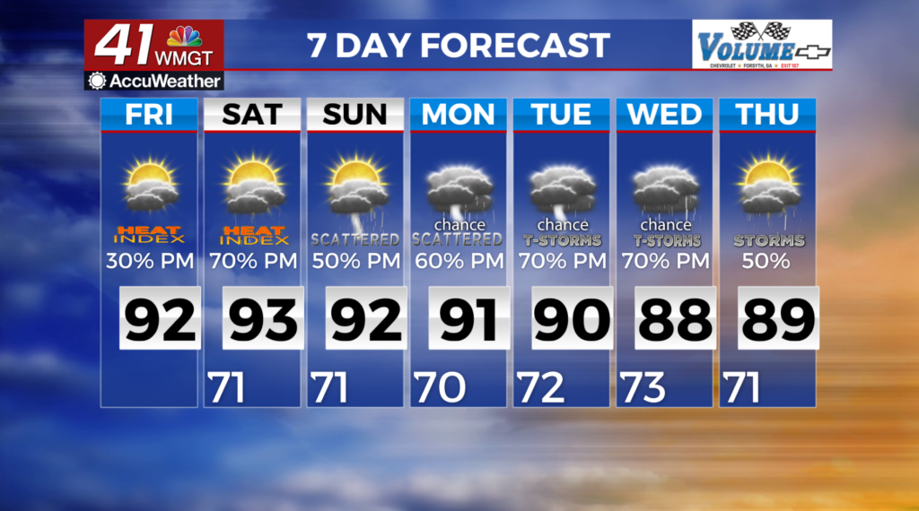
MACON, Georgia (41NBC/WMGT) – For Friday, some isolated thunderstorms will move into the area. The afternoon convection will take longer to get started because the area was worked over 

 from Thursday’s activity, however, there will be ample instability to develop. With the area remaining in southwest flow around the western Atlantic high, diurnally driven convection is again expected. Also, strong to severe isolated thunderstorms will again be possible with strong downburst wind potential. As for temperatures, forecast high Friday should be couple of degrees below Thursday’s highs for most of the area. It will still be hot with heat index values peaking in the 95 to 100 range for North and Middle Georgia. The long term outlook is shaping up to be quite moist thanks to a series of passing systems to the north and another system breaking off in the Atlantic into a closed low and retrograding towards the region. Again most of this rainfall looks to be diurnally driven, meaning the greatest chances of rain and storms will be in the afternoon to evening hours. Repeated rounds of daily rainfall may lead to some flash flooding concerns, especially in more urban areas, although it’s hard to pinpoint any potential locations to be concerned about this far in advance.