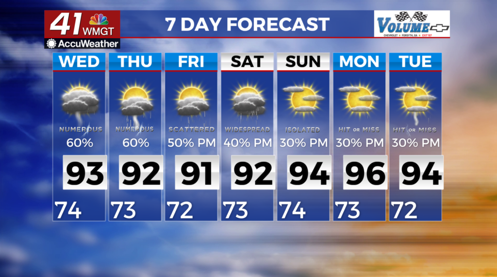
Numerous showers & storms increase by midweek
MACON, Georgia (41NBC/WMGT)-


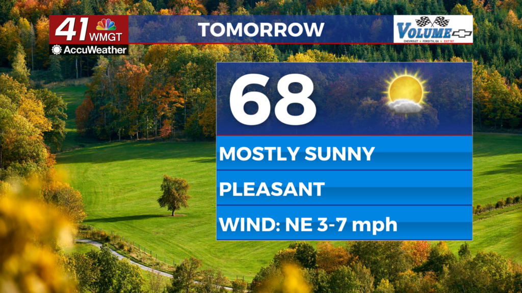
 rounding the base of eastward troughs and moisture transport along the western edge of the Bermuda High will support a return to the diurnally-driven thunderstorm chances that are characteristic of summertime. A moisture rich airmass will continue to fill in across the region over the next few days, and convective coverage will increase. As it does, so will chances for scattered to numerous perhaps, widespread thunderstorms across all of North and Middle Georgia through Wednesday. Instability will be on the lower side by summer standards, so we are not expecting much in the way of severe storm activity. An isolated strong to perhaps marginally severe storm impact (mostly an isolated damaging wind gust) cannot be ruled out. Highs will be in the upper 80s to upper 90s except for the far northeast Georgia, which will be in the upper 70s to 80s. For Wednesday, expect highs to be a few degrees cooler under the influence of greater cloud cover for more numerous storms. With the surging moisture and humidity, widespread maximum “feel like” temperatures will be between 100-104 degrees through midweek. Lows will drop into the 60s to mid 70s.