No rain in sight as temperatures climb
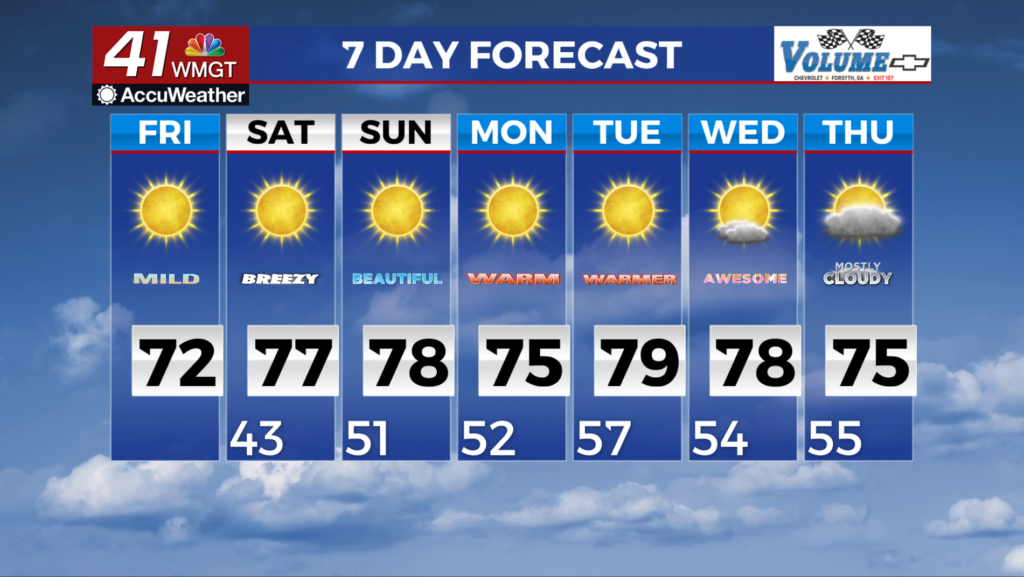
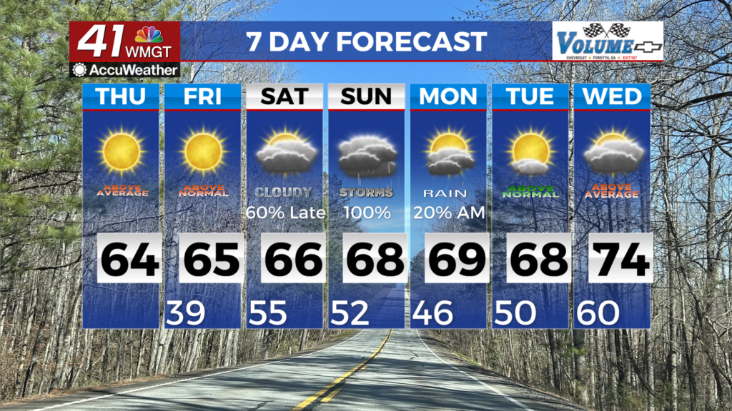
MACON, Georgia (41NBC/WMGT) – High pressure remains over the Southeast through the forecast period, slowly advancing eastward. As a quick moving shortwave swings northeastward 


 into the north Atlantic, a weak ridge sets up within the northwesterly flow to the north of the region which reinforces the high. This influence will inhibit any precipitation chances today and tomorrow. With the center of the high becoming positioned over the region Friday, low level winds will diminish and become light and variable. Temperatures will continue their steady climb under the high pressure system. Highs today will range from the low to mid 70s areawide. Relative Humidity values on Friday afternoon are forecast to reach or briefly drop below 25 percent in Middle Georgia. With fuels remaining dry, a Fire Danger Statement may be issued if dewpoints trend lower in the upcoming forecasts. With clear skies, dry air, and light winds, radiational cooling will be sufficient overnight, with lows dropping to the upper 40s to low 50s. Temperatures will remain mild for Saturday through next Wednesday, as the outlook for needed rainfall in Georgia remains bleak through next week.