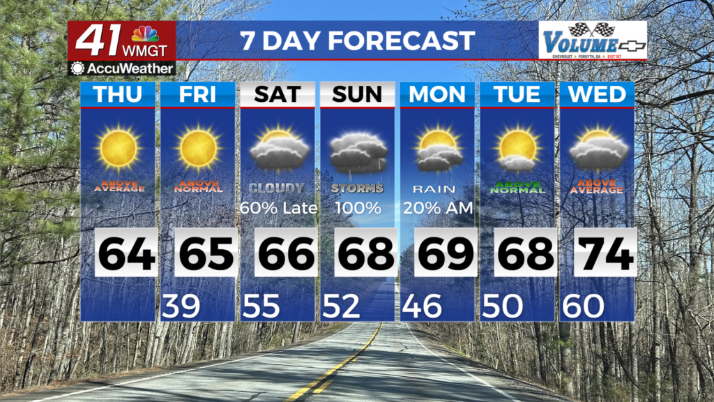
Multiple rounds of showers & t-storms this weekend
MACON, Georgia(41NBC/WMGT) – A weak upper ridge has moved over the Southeast U.S. and a shortwave continues to trek east. This will provide for additional 

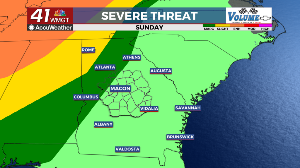
 cloud cover for Friday. The shortwave will move off the coast becoming more zonal. Another low pressure system over the Central Plains dives southeast as it continues to weaken. Southerly flow will continue to inject increased moisture across the area from the Gulf through the weekend. This in conjunction with increasing instability and forcing will support thunderstorm development. The best chances of rain will precede a cold front which will move into the area late Sunday into Monday. The Storm Prediction Center has our area under a marginal risk for severe weather on Sunday and a 15% risk across most of the state for Monday night and Tuesday. The greatest threat appears to be gusty winds with lesser threats for tornadoes and hail. Temperatures continue to run well above normal through most of the period, although the numbers will drop back closer to normal behind the front early next week.