


More heat in store for Middle Georgia
MACON, Georgia (41NBC/WMGT) – The most recognizable feature on the satellite today is the spin of the weak low pressure disturbance over the western coast of Louisiana. Locally, there will 

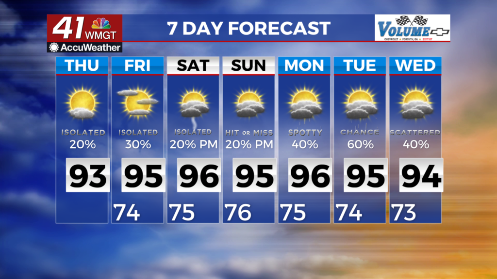
 not be too much impact from this feature with the exception of the plume of deep tropical moisture that will skirt our southwestern counties. Any shower or thunderstorm activity will be isolated with slightly higher coverage possible in the southwest counties. Convection will quickly wane with the loss of diurnal support after sunset. The midlevel ridge centered over the western Atlantic will expand its grip farther westward across the area as the weak low moves further towards the Louisiana coast. As a result, high temperatures are likely to be a couple of degrees warmer, ranging from the low to mid 90s areawide. Afternoon feel-like temperatures will likely reach the 100-104 range across most of the area Thursday afternoon with a few spots potentially nudging 105. Any afternoon/early evening convection will again be quite isolated before diminishing after sunset.