Mild & dry conditions round out the week for Middle Georgia
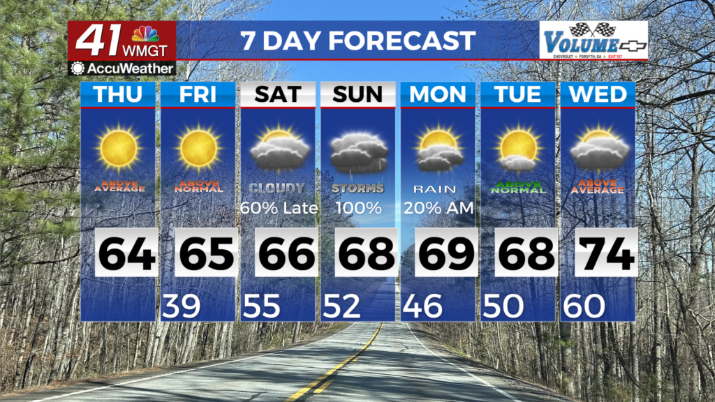
MACON, Georgia (41NBC/WMGT) – The combination of a post-frontal airmass, northwesterly flow at the mid-levels, and high pressure filling in at the surface supports mild and dry conditions 


to round out the week. Fine fuels were able to moisten yesterday afternoon despite light rainfall totals. With relative humidity expected to fall below critical thresholds areawide this afternoon supported by dewpoints in the teens to 20s, a Fire Danger Statement has been issued for all of north and Middle Georgia through 6 PM. Please exercise caution if you plan to burn outdoors. Winds kicking over to the east on Friday should allow for some improvement dewpoint-wise, but conditions will be monitored. Despite the complete frontal passage, highs will remain on the warm side– topping out in the mid 50s to 60s today and Friday. Morning lows on Friday will be crisp, in the 30s to near 40. The extended forecast begins with high pressure centered over the Carolinas keeping things dry across the region. This ridge moves offshore Saturday morning which puts Georgia in a warm, moist southerly flow ahead of the next weather system moving into the region. By daybreak Saturday, the closed low system is expected to be centered over the Texas panhandle as it moves east into the Mid to Lower Mississippi River Valley through Saturday night. Deep moisture ahead of the low center pushes into North Georgia Saturday evening with precipitation spreading across the state through Sunday morning. Instability with this system stays weak especially Saturday night so this will mainly be a showery event. Things become a little more unstable for Sunday but it’s not too bad. Sunday afternoon temperatures get up into the 60s and lower 70s so we will have minimal ingredients for thunderstorm activity. An isolated strong storm cannot be ruled out, but the threat for severe weather remains low at this time.