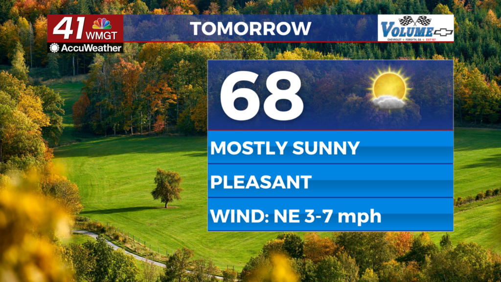
Middle Georgia begins to dry out as temps rise
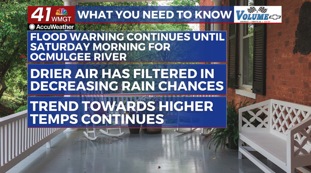
MACON, Georgia (41NBC/WMGT) – The Flood Warning continues for the Ocmulgee River until Saturday morning. For today drier air is in place across the state. With the erosion of the wedge, 

 additional heating is expected. Daytime highs will surge into the mid 70s to upper 80s. With this additional energy and decreased stability, the influence of the wedge begins to weaken, pop-up thunderstorms will be possible during the afternoon and evening hours. The highest risk will be in Middle Georgia into south Georgia. Isolated showers cannot be ruled out. Heading into Friday, we will see an easing of some of the heavy rain that we’ve seen over the past few days and a gradual return to temperatures that we would normally expect for this time of the year. Upper level relative humidity values remain on the wet side and a southerly flow means afternoon thunderstorms will be the trend through the first half of the week.