


Isolated showers and warmer temperatures today
MACON, Georgia. (41NBC/WMGT) – After a sunny and dry Monday, we will see a return of moisture to Middle Georgia today that will hang around for the next several days.
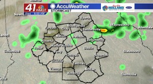
TODAY.
The area of high pressure that was building in behind Sunday mornings cold front is quickly racing off to the east, and the further it moves away we will see more clouds as well as increasing rain chances. This afternoon we will continue to add in more clouds, and a few light showers cannot be ruled out as well. Rain chances will be running at 20% on your Tuesday afternoon and evening. As we get into the early night hours, clouds will quickly move in and that will lead to a mostly cloudy sky. With the added cloud cover temperatures will stay on the warmer side compared to the past several mornings.
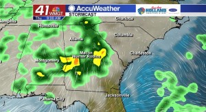
TOMORROW.
We will start off Wednesday morning with a mostly cloudy sky and warmer temperatures compared to the past couple of mornings. As we head into the afternoon hours temperatures will quickly rise into the low and mid 70’s. Isolated showers will again be in the forecast with rain chances running at 30%. Overnight temperatures will be falling into the middle 50’s under a mostly cloudy sky.
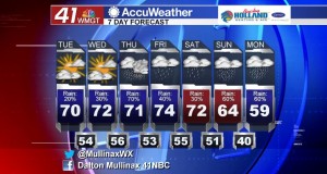
REST OF WEEK.
Thursday will be the wettest day of the work week as a cold front sweeps through Middle Georgia bringing with it the chance for a few thunderstorms. While pockets of rain could be heavy, rain totals are expected to total less than half an inch. This cold front will not have much of an impact on temperatures as rain associated with the front is the main development.
 Meteorologist Dalton Mullinax on Facebook (Dalton Mullinax 41NBC) and Twitter (@MullinaxWX) for weather updates throughout the day. You can also watch his forecasts Monday through Friday on 41NBC News at Daybreak (5-7 a.m.) and 41Today (11 a.m.).

Leave a Reply