


Isolated showers and storms to continue over next several days
MACON, Georgia. (41NBC/WMGT) – Showers and thunderstorms from yesterday will return this afternoon albeit with less coverage.
TODAY.
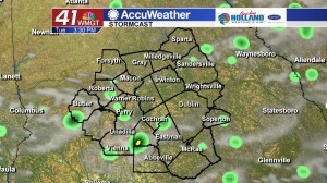
Temperatures will be quick to climb into the lower and middle 90’s this afternoon under a partly sunny sky. Isolated showers and storms will begin to form after lunch time, but coverage of these showers and storms are expected to be less than we have seen the past couple of days as slightly drier air in the mid-levels of the atmosphere moves into the Peach State. Overnight tonight, temperatures will cool off into the lower 70’s under a partly cloudy sky. A lingering shower or two is possible through midnight.
TOMORROW.
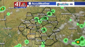
A similar day will unfold on Wednesday as temperatures will be running near the normal high temperature of 92° for this time of year. Rain chances are running roughly at 30%.
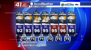
REST OF WEEK AND BEYOND.
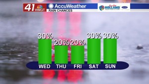
Isolated showers and storms driven by the heating of the afternoon will continue over the next several days. Where these storms set up we could see locally heavy rainfall, but widespread coverage of heavy rain is not forecast. Temperatures will be warming up into the middle 90’s as we head towards the middle and end of the work week.
 Follow Meteorologist Dalton Mullinax on Facebook (Dalton Mullinax 41NBC) and Twitter (@MullinaxWX) for weather updates throughout the day. You can also watch his forecasts Monday through Friday on 41NBC News at Daybreak (5-7 a.m.) and 41Today (11 a.m.).

Leave a Reply