Isolated showers leads to warmer temperatures on Thursday
MACON, Georgia (41NBC/WMGT) – A weak shortwave moved through the region earlier today that supported scattered showers and isolated thunderstorms in North Georgia. As we moved 
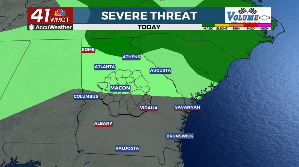
 into the afternoon, daytime heating and a building upper level ridge will battle for control over convection. Rising temperatures and surface dewpoints in the middle 60s will greatly improve the amount of potential instability to form these storms. Northeast Georgia has the best potential for these thunderstorms to form. A couple of those storms could be severe. The primary hazard is quarter-sized hail. Damaging wind gusts could also occur. The Storm Prediction Center has upgraded Northeast Georgia to a Marginal Risk (level 1 of 5) for severe weather, with hail being the focus. Thunderstorm chances should decrease rapidly with the loss of diurnal heating this evening. Low cloud cover should return overnight. Across Middle Georgia a few patches of fog could develop. The upper level ridge will be in firm control of the weather, in Middle Georgia on Thursday. This will lead to warming temperatures and dry weather. Widespread high temperatures in the 86 to 91 degree range are expected.