


Isolated shower for Wednesday, then drying out on Thursday
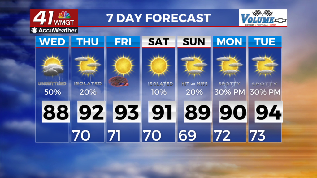
MACON, Georgia (41NBC/WMGT) – A drying trend begins during the day. There will be a significantly decreased threat for thunderstorms today. Some lingering moisture is anticipated over 

 Middle Georgia into Eastern Georgia where isolated to scattered thunderstorms will be possible. A few isolated thunderstorms will also remain possible northward into the Atlanta metro during the afternoon tomorrow, due to a combination of daytime heating and lingering moisture. Models are in good agreement on the overall pattern of a strengthening ridge over the mid Mississippi Valley by Friday and a remnant low over Florida. This is the same system responsible for the National Hurricane Center 30% area outlook. The Southeast region will be under the influence of both the dry northwest flow on the east side of the ridge and the dry side of the low. The end result will be a drying trend as well as a warming trend with temps 3 to 5 degrees above average Thursday through Saturday and very low, but not zero percent of chances of precipitation.