
Hurricane Dorian forecast to become a Category 4 storm by Sunday
As of 9:30 pm we haven’t seen much change in the intensity of Dorian, but after a fly through from the Hurricane Hunters, we are seeing a decrease in central pressure. This is a main indicator of strength when it comes to tropical systems and something we will be watching closely.
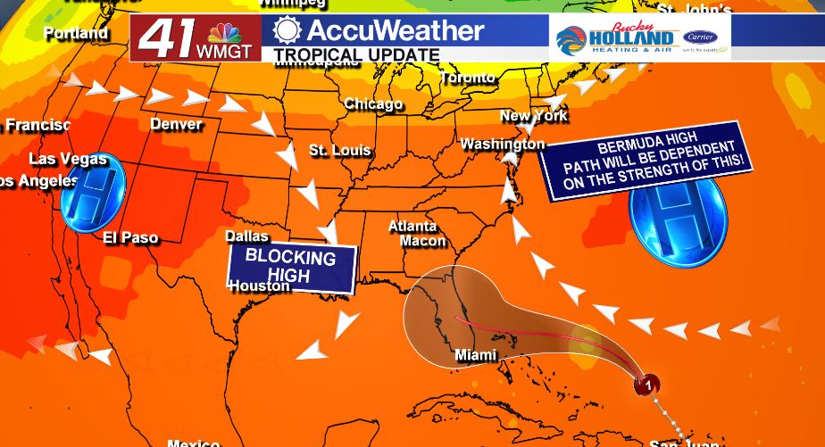
Models continue to be (kind of) all over the place. I realize that is not helpful, but that is what we got. At this point it looks like much of what will determine the movement of the hurricane is the Bermuda High which sits just off and into the east coast. If that stays strong, we will likely a more southern approach to the Florida coast (Miami or Melbourne).
That being said, if that high starts to weaken a bit it could allow the storm to turn to the north a little earlier than currently predicted…once again, I realize this is no help, but knowing what we are looking for puts us in a better place in general.
It is also entirely possible that this storm just rides up the east coast and doesn’t make landfall anywhere…this is the least likely option, but I should still be stated that it is possible.
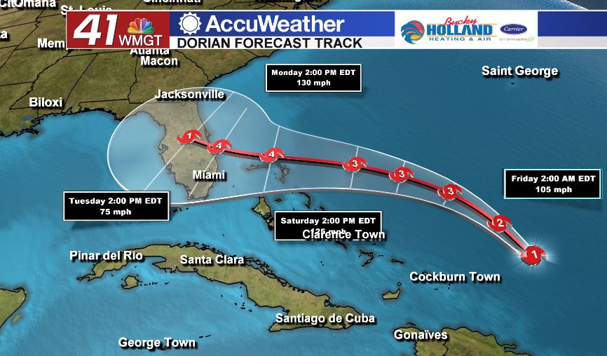
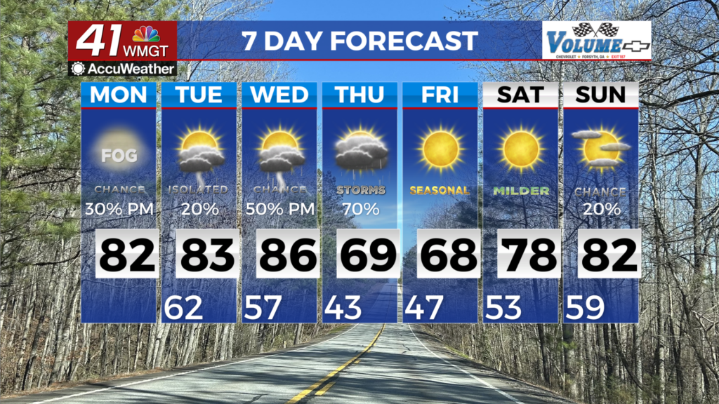
Regardless of the options, the current NHC forecast brings this to the east coast of Florida (somewhere) as a category 4 hurricane. That will be life threatening whether this makes landfall or not. Now is the time to prepare, even here in Middle Georgia, where we have over 3 days before we likely see any impacts.

Leave a Reply