


Hot day ahead of strong storms
MACON, Georgia (41NBC/WMGT) – High pressure remains positioned over the Southeast as a cluster of convection has attached itself along the line. Ample heating will occur across 
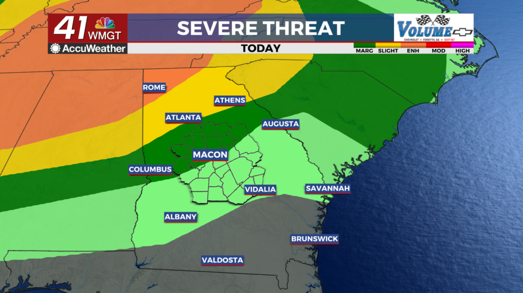
 North Georgia as morning cloud cover will scatter out and upper level cloud cover shifts east. As the atmosphere continues to juice up, this will allow for strong updrafts to occur and outflow boundaries to form. Once deep convection starts, strong updrafts will support and storms may grow upscale into clusters as they move southeastward. The Storm Prediction Center is maintaining a Slight Risk (Level 2 out of 5) across portions of North Georgia this afternoon and evening, with a Marginal Risk (Level 1 out of 5) further south, across much of Atlanta. This convection will taper off this evening with the loss of daytime heating. Cloud cover will last through the overnight hours. Like the previous couple of days, patchy fog may develop early Tuesday morning. Through the day expect a shortwave to bring a potential for an organized system of strong to severe thunderstorms Tuesday night, especially north and west of I-85. Most of the day will be dry and hot. Highs in the upper 80s to lower 90s.