
High heat levels move into Middle Georgia
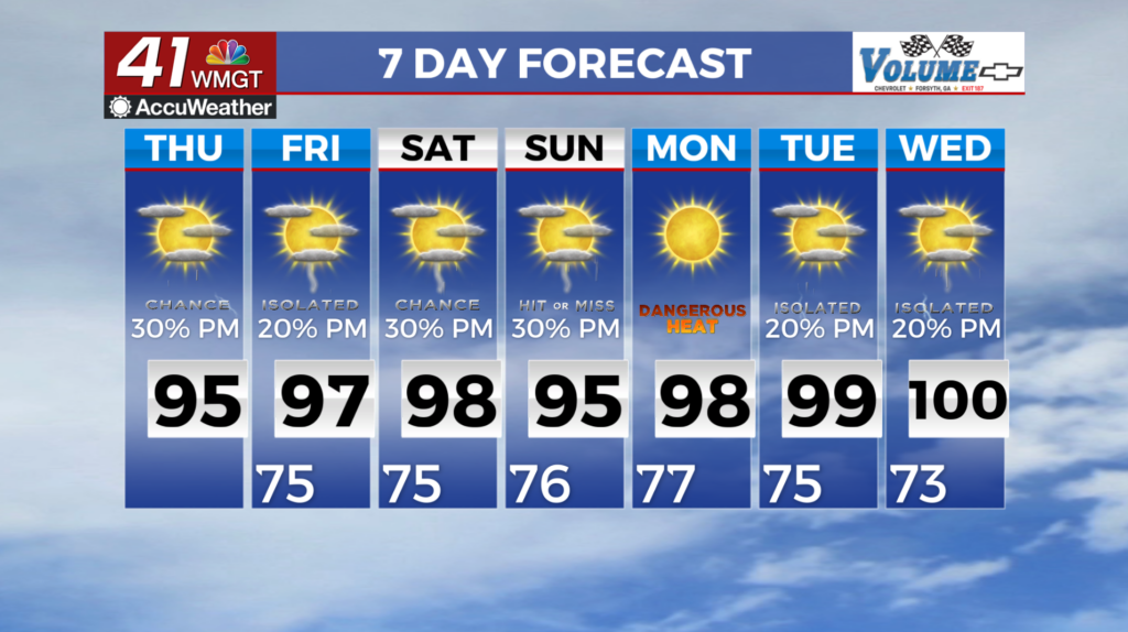
MACON, Georgia (41NBC/WMGT) – The past few days we have been mainly experiencing storms that have stayed below severe thresholds, however, an isolated severe storm or two can’t be ruled 


out. Northwest flow is expected to continue over the next few days with a few waves moving getting caught in the flow and moving across the area. So far there isn’t enough shear available so it looks like the greatest convective threats are periods of heavy rain, frequent lightning strikes, small hail, and strong gusty winds. Temperatures will increase a bit Thursday from yesterday allowing portions of East and Middle Georgia to meet Heat Advisory criteria. The National Weather Service has issued a Heat Advisory in effect for portions of Middle and East Georgia for Thursday afternoon. As the long term period begins on Friday morning, the axis of an upper level ridge will be centered roughly along the Mississippi River Valley. This ridge will gradually shift eastward 


and amplify over the course of the day on Friday and into Saturday. Temperatures will continue their steady climb underneath the ridge, with afternoon highs on Friday forecast to be in the upper 90s in areas south of I-85 and in the mid 90s to the north. Deep moisture lingering across the area will contribute to dewpoints in the low to mid 70s. The combination of heat and humidity will contribute to heat index values in the triple digits across the majority of the area, with values between 105 and 109 in portions of Middle and East Georgia, which will warrant the issuance of another Heat Advisory for Friday afternoon. High temperatures will be a couple of degrees warmer areawide on Saturday, which could bring heat indices across the majority of the area above Heat Advisory criteria and allow locations in East-Central Georgia to flirt with heat indices of 110 degrees! The suppressive high pressure conditions should support a reduction in precipitation chances through the beginning of next week, with models showing diurnal storm chances dwindling to isolated coverage as we move into the weekend. One caveat is the continuation of northwesterly flow, at least until Friday, followed by any disturbances that may transit the edge of the ridge, which could enhance or trigger a few more afternoon thunderstorms than currently expected. If so, some of these storms could produce gusty winds and locally heavy rainfall.