High heat and humidity returns to Middle Georgia this week
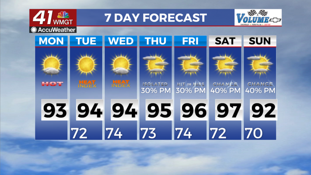
MACON, Georgia (41NBC/WMGT) – We will see our daytime temperatures begin to climb into the upper 80s to low 90s over the next couple of days with less cloud cover. The higher temps 


combined with low-level moisture advection will keep dewpoints in the low to mid-70s over most of our area making it feel uncomfortable in the afternoons. As a result, the Heat Index will climb into the mid 90s to low 100s through Monday afternoon everywhere outside of the mountain counties. This will likely fall below the Heat Advisory criteria, so we will keep an eye out as we move further into next week. There are no big changes in the expectations for the bulk of the extended forecast period that will bring hot and mostly dry conditions with any hope for a pattern change delayed until at least next weekend. Above normal temperatures will peak during the midweek timeframe as the expensive upper ridge reaches its apex across the region. Widespread highs in the 


mid 90s and heat index values near and over 100 degrees are expected. This will also serve to greatly limit rain chances for the vast majority of the area with any appreciable chances for diurnal precipitation shunted to the far southern counties. Hints of any pattern change will hold off until next weekend when the upper ridge may retrograde westward, potentially setting up a trough across the Eastern U.S. and allowing a frontal boundary to push towards the area. This will also have a hand in determining the eventual track or evolution of the wave associated with the remnants of former Tropical Storm Dolly and its associated moisture. Given this remains a week away, there is plenty of uncertainty in the details, so at this juncture probability of precipitation gradually increase by next weekend.