


Heavy rain and a few storms to hang around
MACON, Georgia. (41NBC/WMGT) – Grab the rain gear if you have not already and be prepared to use it over the next couple of days as waves of heavy rain with a few embedded thunderstorms moves through Middle Georgia.
TODAY AND TOMORROW.

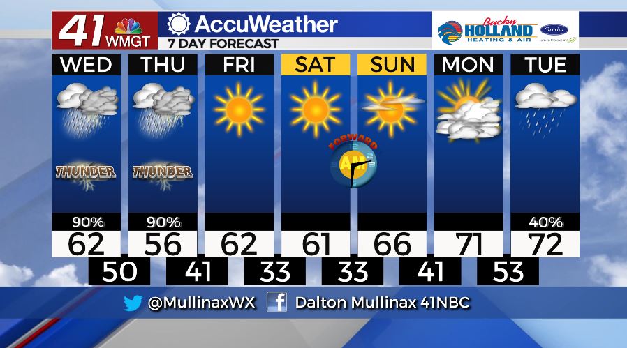
The next couple of days will be extremely wet across our area. Widespread showers and a few thunderstorms are forecast to move through between now and Friday morning. The greatest threat for strong and severe storms over the next couple of days will stay to our south, but an isolated strong storm with gusty winds cannot be ruled out completely. This afternoon temperatures will top out in the low to middle 60’s before falling to near 50° tonight. Tomorrow, temperatures are even cooler with highs expected to only make it into the middle and upper 50’s before falling into the upper 30’s and lower 40’s by daybreak on Friday. An additional two to four inches of rain is expected to fall widespread across the area between Wednesday morning and Thursday night.
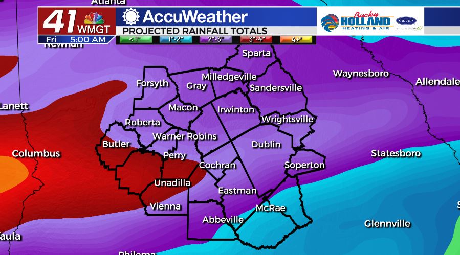
As of 5 am on Wednesday, March 4, the National Weather Service in Peachtree City has issued a Flash Flood Watch that runs through tomorrow afternoon.
FRIDAY AND BEYOND.
We’re dry on Friday and these conditions will last through the weekend. Temperatures will gradually warm as we head towards next week.
Follow Meteorologist Dalton Mullinax on Facebook (Dalton Mullinax 41NBC) and Twitter (@MullinaxWX) for weather updates throughout the day. You can also watch his forecasts Monday through Friday on 41NBC News at Daybreak (6-7 a.m.) and 41Today (11 a.m).

Leave a Reply