

Heat, wind, and clouds increase as Dorian nears the Georgia coast
Dorian has seen significant weakening through the day on Tuesday, but we are expecting it to maintain category 2 status through the next few days. This means that although it will likely stay off the Georgia coast, hurricane force winds, heavy rain, and significant storm surge are possible through Thursday.
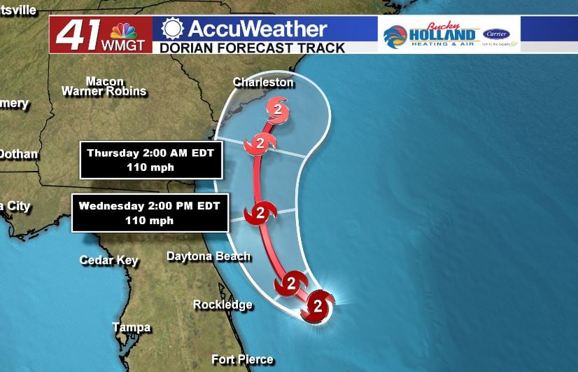
The National Hurricane Center has stayed pretty consistent with their latest forecasts and continue to keep the landfall predictions away from Georgia. This being said, South and North Carolina could see the worst of the storm as it could make landfall on Friday.
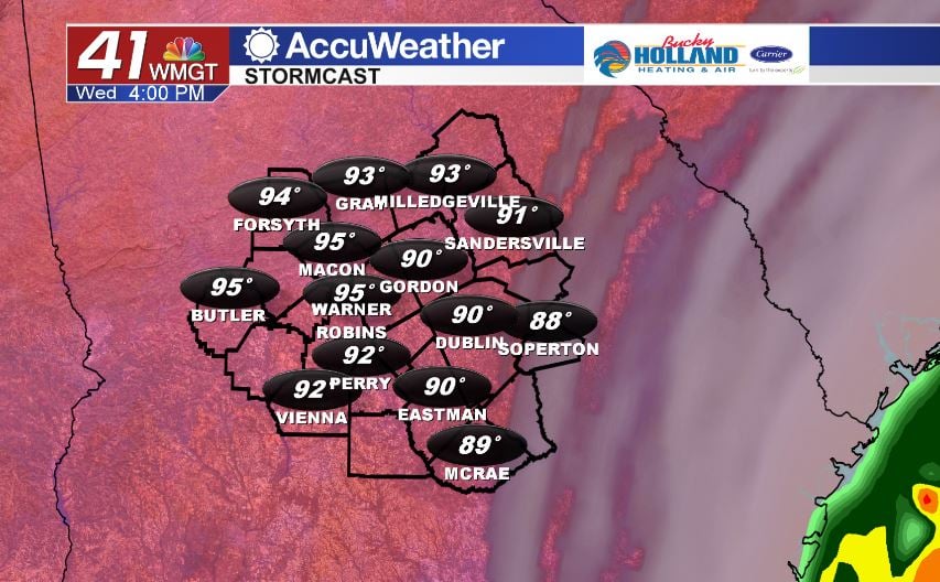
Back at home we are expecting a hot day across Middle Georgia. Highs will be back int he middle 90’s with high humidity as well. Clouds will be on the increase through the day as Dorian gets closer. We will also see our winds around 15-20 mph by late afternoon.
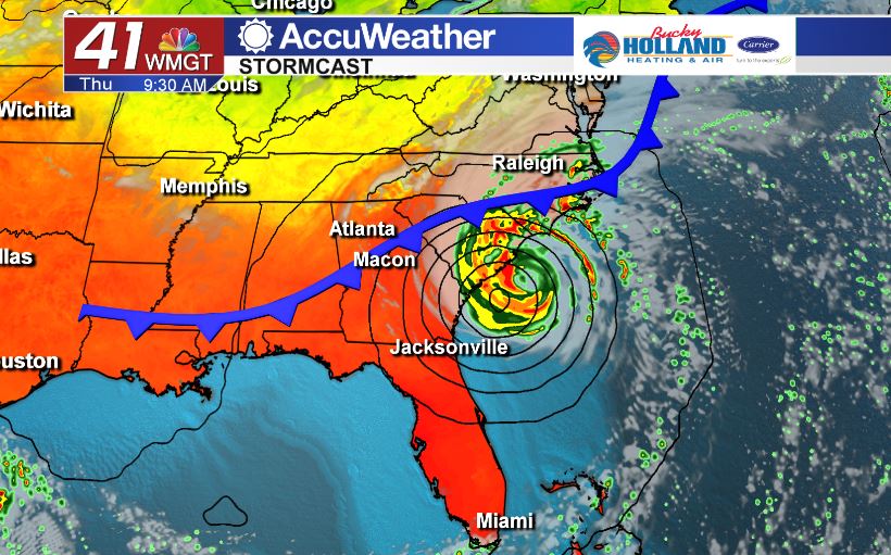
Dorian will move up the coast and Friday will be of no concern for the southeast. Behind Dorian, Middle Georgia will see our highs back in the upper 90’s with plenty of sunshine for the weekend.


Leave a Reply