
Heat, humidity and storms continue Tuesday in Middle Georgia
Heat and humidity were out in full force across the southeast today as Tropical Depression Cristobal moves north.
As Cristobal moves north and gets absorbed by our next system, we continue to see tropical moisture being drawn across Georgia. Thus increasing our humidity and and our heat index values into the upper 90’s and low 100’s.
We have also been seeing scattered showers and thunderstorms through the day today, which will continue into tomorrow afternoon and evening. While it is possible that a few storms could be strong, widespread severe weather is not expected.
Regardless, tropical downpours will be possible in storms that pop up through the next few days ahead of a cold front.
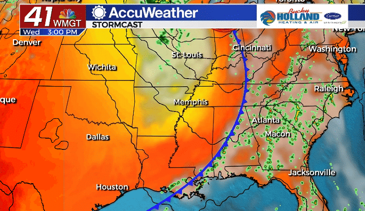
Our next cold front will push in through the day on Wednesday, but scattered storms will continue ahead of the front.
A few of these storms could be strong to severe, with the main threat being damaging winds. Tropical downpours will also be possible through the day on Wednesday.
The cold front will unfortunately stall right around Middle Georgia on Wednesday night, which means that we won’t see a huge cool down or anything.
We will be right on the edge of some much drier air, but we will have to see if that filters into our area.

The stalled front will keep some scattered storms in the area through the end of the week. Highs will stay around normal through the weekend as lows fall into the 60’s.


Leave a Reply