Gusty winds and light showers highlight Wednesday
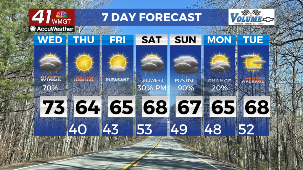
MACON, Georgia (41NBC/WMGT) – Showers are ongoing this morning across portions of north and west Georgia ahead of an approaching cold front. Rain coverage increases to the south and 


east into the afternoon accompanied by breezy winds, with drying expected by late this evening or very early Thursday morning as the front exits to the south. Rainfall totals will remain on the light side, with up to three-quarters of an inch to an inch possible, tapering off to just a tenth of inch or less. Highs will be a tad bit cooler along and north of the I-20 and I-85 interchange due to increased cloud cover, topping out in the 60s. Areas further south, where accumulations are more likely to be minimal, will continue to see high in the low to mid 70s. Behind the front, midlevel flow swings back northwesterly, with high pressure filling in at the surface. As a result, expect mostly clear, dry, and mild conditions on Thursday. Morning lows will be cooler, in the mid 30s to lower 40s areawide. Despite the complete frontal passage, highs will remain on the warm side, topping out in the mid 50s to 60s. Thursday brings fire weather concerns as ridging begins to settle back into place and relative humidity values could reach below 25% for much of the area. Recent rainfall should help however, very dry conditions are expected. Ridging becomes more zonal before Friday when we see the next low pressure system form over the Four Corners region. Saturday should see this system push eastward before fully entering the area on Sunday which leads to widespread rain chances.