
Flash Flood Watch issued ahead of our next rain event
Good evening,
The sunshine from the weekend has now made an exit from our forecast for quite a while…sorry.
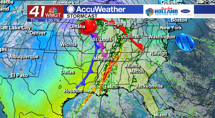
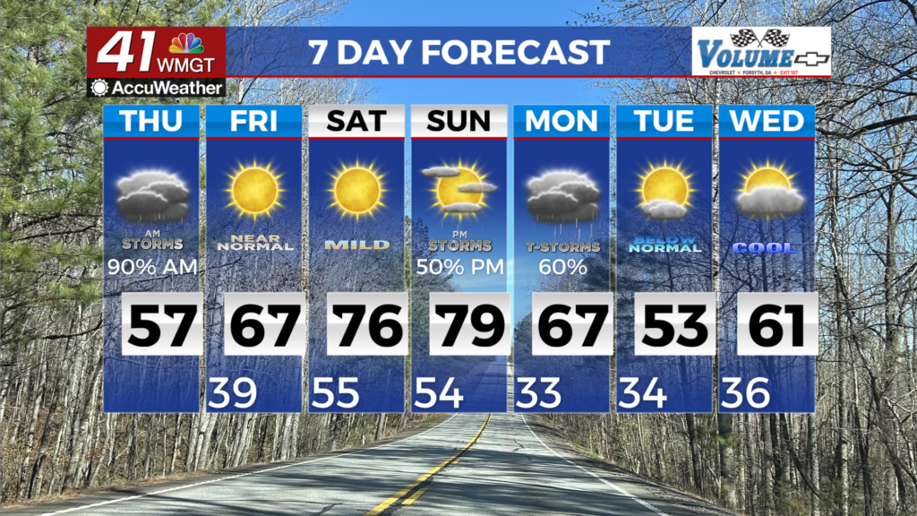
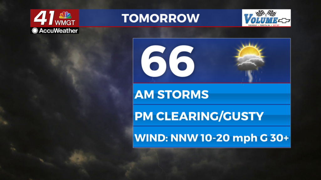
A large weather system is moving through the middle of the country right now, bringing heavy rain and severe storms to parts of Texas and Oklahoma. The system will begin to impact the Middle Georgia area beginning Thursday, to start our trend of wet weather through the end of the year. Expect scattered showers with embedded heavy rain possible on Thursday, mainly during the afternoon.
By Friday a line of potentially strong storms will push through the area. This will bring mainly a threat of heavy rain and gusty winds, but a strong to severe storm can’t be ruled out. We will have to wait until tomorrow to get a better handle on timing and intensity.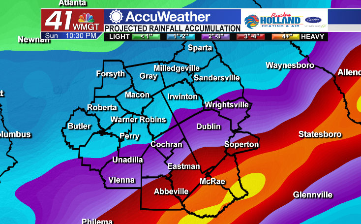
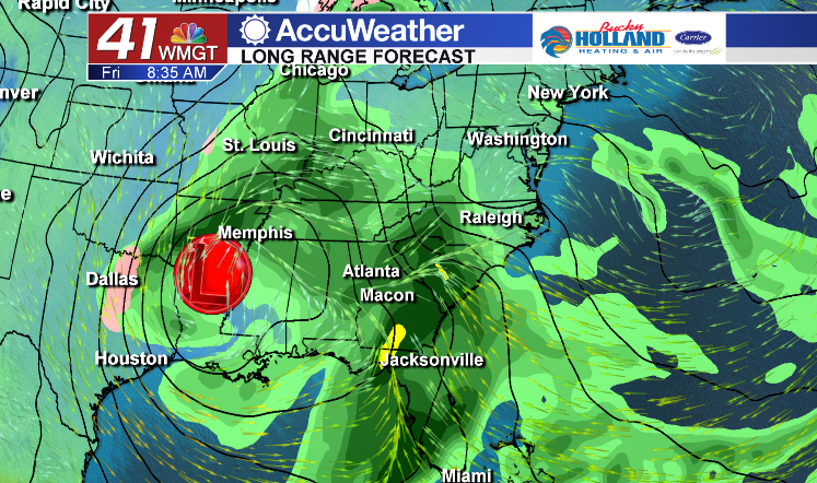
Much of Middle Georgia is expected to see over 1″ of rainfall and up to 2″ through Friday night before our next round of heavy rain moves in for the weekend through the end of the year.
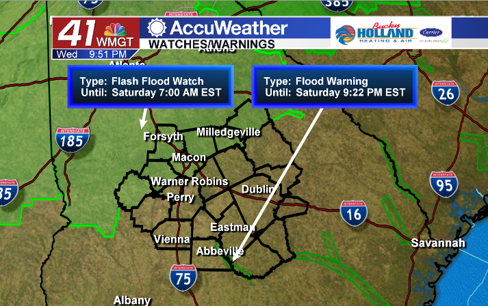
As we are expecting heavy rain on already saturated soils, a Flash Flood Watch has been issued for parts of Middle Georgia through Saturday morning.

Leave a Reply