Fire weather conditions for portions of Middle Georgia
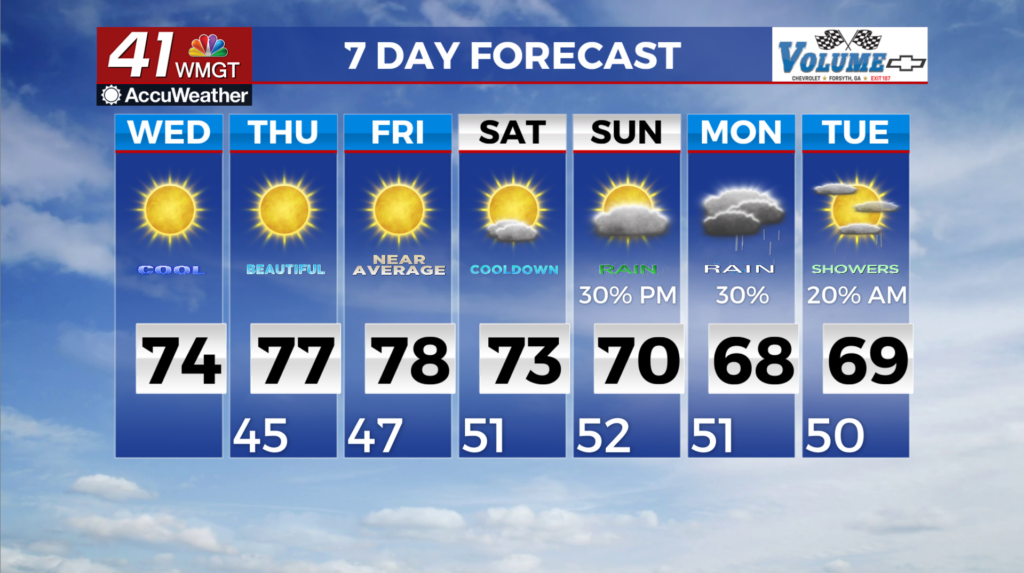
MACON, Georgia (41NBC/WMGT) – Critical fire weather conditions are possible for the southeast part of the coverage area. Temperatures will rise into the mid to low 70s with overnight lows 


 falling into the upper 30s and low 40s. Dewpoints behind the front will fall into the 30s and 40s tomorrow making it feel very dry out there. The remainder of the work week brings dry weather as sprawling high pressure extending from the Upper Midwest into the Southeast at the start of Thursday will only shift east through Saturday. Thursday through Saturday will bring primarily seasonal temperatures overall. Highs will warm into the 70s each day while lows will run several degrees below normal, bringing widespread 40s Friday and Saturday mornings. The only concern through the end of the week will be the likelihood of critical relative humidity thresholds for fire weather, especially Thursday and Friday afternoons as drier air mixes to the surface. Confidence remains uncertain by the latter half of the weekend into early next week, particularly regarding the potential for increasing rainfall coverage. There remains model support for gradually increasing moisture ahead of a closed upper low moving across Texas and the Southern Plains by Sunday. The evolution of this system beyond this point is unclear, and models continue to indicate relatively low probabilities for substantial rainfall through Monday. While forecast details should come into better focus over the next few days, the probability of receiving sufficient rainfall to make a dent in our ongoing drought remains quite low.