Fair weather and gradual warming for Middle Georgia
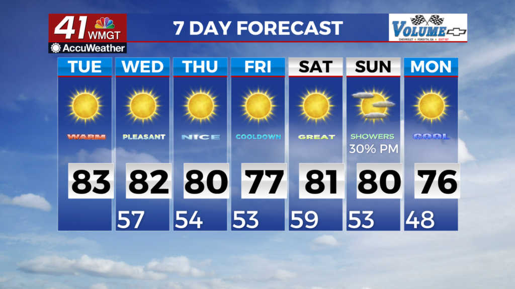
MACON, Georgia (41NBC/WMGT) – Dry, warm, and mostly sunny conditions continue across North and Middle Georgia. This pattern is being driven by deep northerly flow over the state, as 


 it sits between high pressure and ridging over the Central U.S., and a stacked low pressure system off the Atlantic Coast. Between the dry airmass and the subsidence from the ridging, cloud cover will be minimal. Under the mostly sunny skies, high temperatures will reach the low to mid 80s. In the mountains of North Georgia, temps will be about 5-10 degrees cooler. A mid-level ridge will be in place across the Mississippi Valley and extending into the Southeast from Wednesday to Saturday. This set up will favor the continuation of warm and mostly dry weather across the region. Daytime highs will range from the upper 70s to the mid 80s through the period. Expect temperatures to be 5-10 degrees cooler in the northeast Georgia mountains. Overnight temperatures remain on the cooler side with values in the 50s. There remains a potential for rain sometime late this weekend, as a trough and associated low pressure system sweeps across the Plains towards the Southeast. Latest models suggest the amplification of the trough to the west resulting in the breakdown of the mid-level ridge. How much strengthening occurs and the impact it will have on the ridge in place remains to be seen. Current thinking is that any meaningful precipitation greater than an inch, remains unlikely.