
Even more rain and tropical development likely through the weekend
Good Evening!
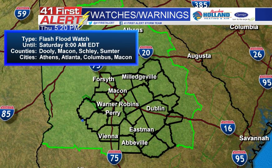
We have had no shortage of rainfall the past week in Middle Georgia, and the rain continues through the weekend. A Flash Flood Watch has been issued for all of Middle Georgia and Metro Atlanta until 8am Saturday.
Scattered storms are expected to impact the Middle Georgia area throughout the end of the week and the weekend with several inches of rain possible, as tropical moisture continues to hang around. Of course the main concern is heavy rain from the next potential tropical cyclone.
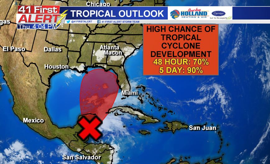
Right now the National Hurricane Center has set the probabilities of development at high levels (70% within 2 days, 90% within 5 days). The center of circulation right now, is over the Yucatan Peninsula, but is expected to move over warm waters and an area of less wind shear. By the time the system is in the Gulf of Mexico it is expected to become Tropical Storm Alberto.
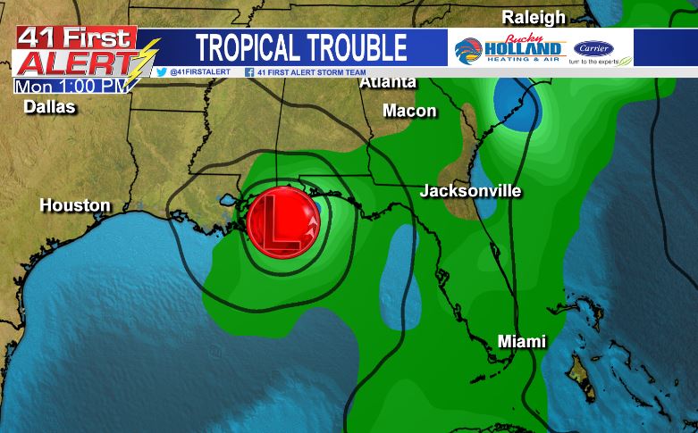
Multiple weather models bring the system onshore somewhere between Louisiana and Florida, likely by Monday. Once it makes it onshore it looks like the system begins to slow down, which isn’t great for already saturated soil in Middle Georgia.
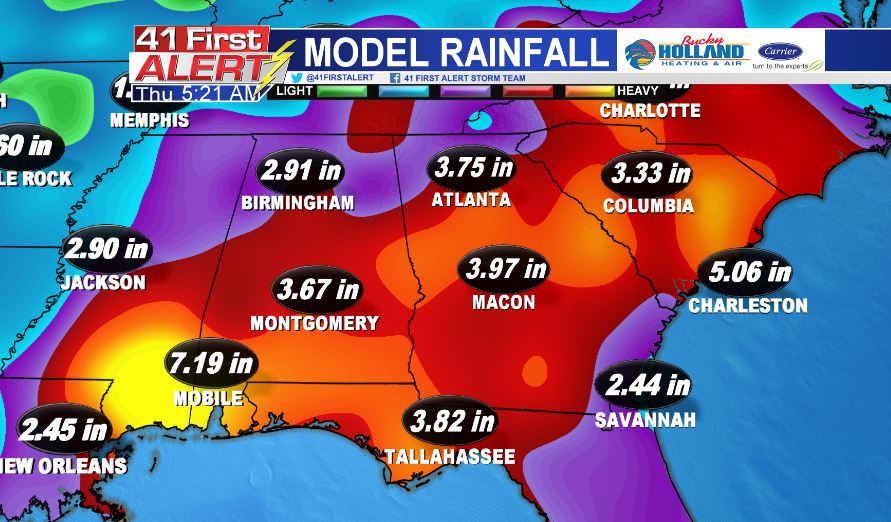
The main threat through, will be flash flooding, which is one of weather’s major killers. We will keep a close eye on these systems, but it is looking like a soggy weekend is on the way across the Southeast.
Stay safe this weekend!
Chief Meteorologist Cecilia Reeves


Leave a Reply