


Elevated severe weather threat expected Thursday
MACON, Georgia. (41NBC/WMGT)- While a few strong storms are possible this afternoon and evening, the greatest severe weather threat for Middle Georgia moves in early tomorrow and will continue into the early afternoon. This threat is significant and should be taken VERY seriously.
TODAY:
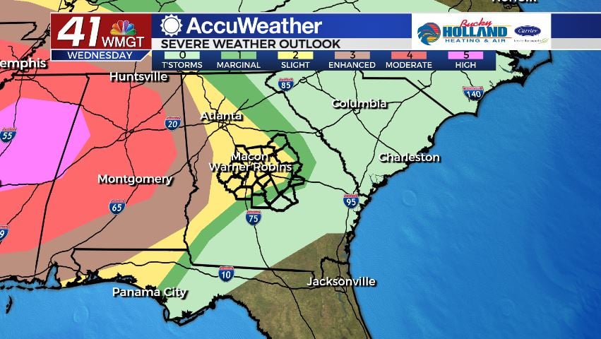
– A few strong to potentially severe storms are possible on Wednesday afternoon and evening. Damaging wind gusts will be the main storm threat along with a vey low, but not zero, tornado risk.
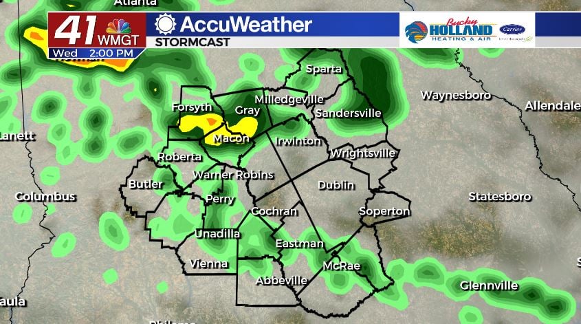
– Timing for any organized storms looks to be from the early afternoon until sunset (7:44). We will see a break in the action overnight before more storms move in tomorrow morning.
– A large chunk of our area is in a Slight (level 2/5) risk area for today.
TOMORROW:
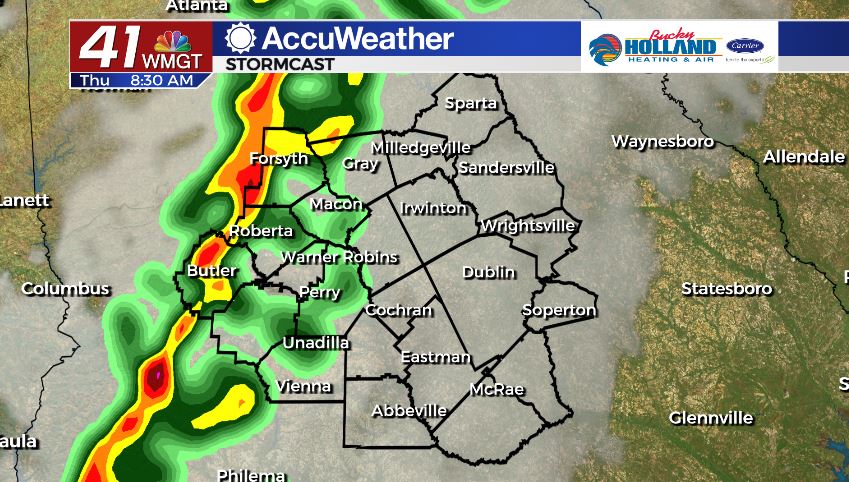
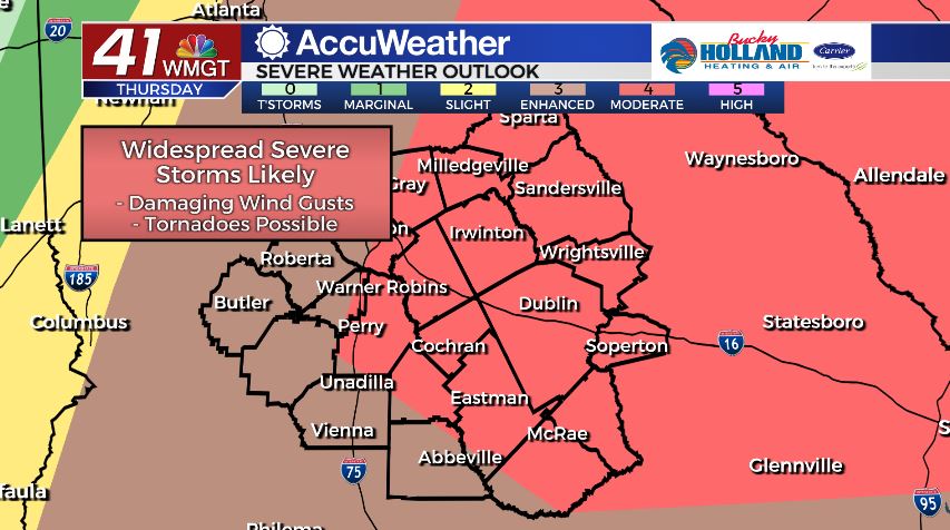
– A dynamic storm system will bring an increased chance for severe storms to our area beginning tomorrow morning. Damaging wind gusts along with an elevated tornado risk is in play.
– Timing for this particular round of severe weather will begin around 6 am and continue through the early afternoon.
– Many of our counties have been placed in a Moderate (level 4/5) risk area for tomorrow.
NOW is the time to prepare…
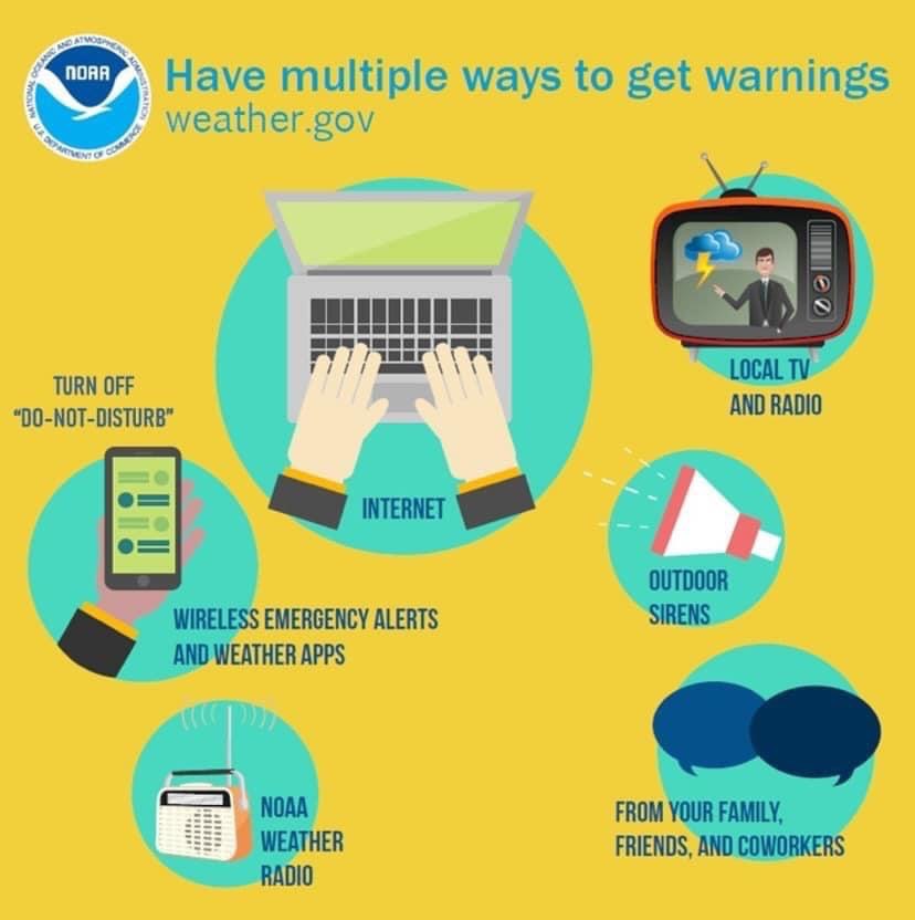
1. Make sure you know how you are getting your severe weather alerts. Have MULTIPLE ways to get them (Weather Radio, 41NBC Accuweather App, Alerts on phone)
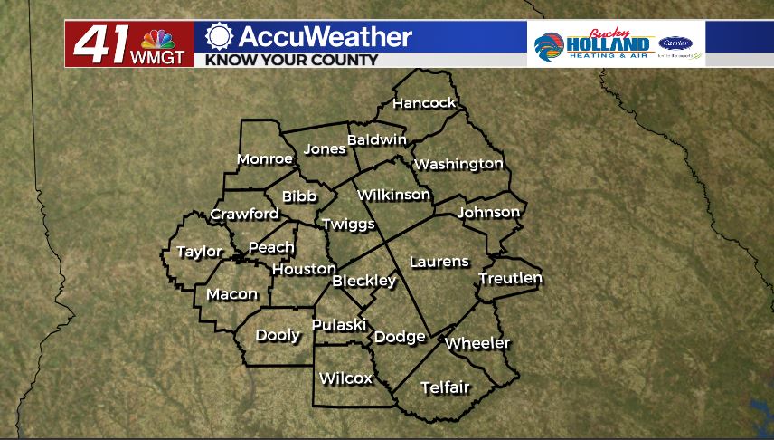
2. Know how to find your county on our map. Check out the map below and make sure you can find your location.
3. Share this information with someone. If you have friends or family that could be impacted LET THEM KNOW.
Follow Meteorologist Dalton Mullinax on Facebook (Dalton Mullinax 41NBC) and Twitter (@MullinaxWX) for weather updates throughout the day. You can also watch his forecasts Monday through Friday on 41NBC News at Daybreak (6-7 a.m.) and 41Today (11 a.m).

Leave a Reply