


Dry and warm Tuesday, rain and storms later this week
After a cool Christmas and weekend, we are finally warming back up here in Middle Georgia.
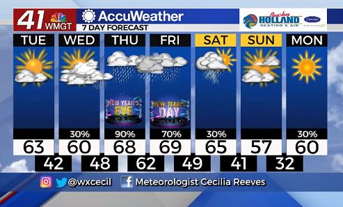
Highs today made it to the upper 60’s across Middle Georgia, and 60’s will be hanging around through the end of the week (some of us could even see 70’s)
A cold front is moving through tonight, and this weakening front won’t bring too much of an impact to our area.
Tomorrow will probably be our nicest day of the rest of the week with partly cloudy skies and highs in the 60’s.
The rest of the week is all down hill with scattered showers returning Wednesday.
Now that that is out of the way, we have to talk about later this week…
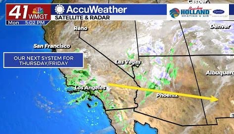
This system (pictured above) on the west coast will bring our next chance of strong/severe storms.
This low pressure will travel through Texas and Mexico eventually making it to the southeast.
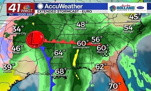
New Year’s Eve looks like it could be a messy one across the southeast.
Based on the data right now, it looks like we will just see some heavy rain and storms.
The real threat for severe storms will be kept closer to the cold front.
That being said, the cold front will be moving through some time on Friday.
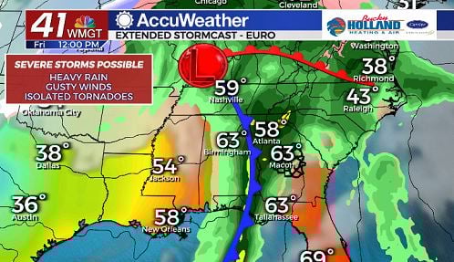
This is when we are going to need to keep a close eye on the storms moving through.
Main threats with these storms will be damaging winds, heavy rain, and the chance of an isolated tornado.
As per usual, things will change as the system gets closer, so we will continue to update you on the latest.
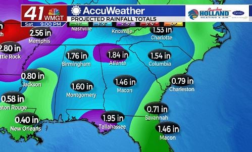
Rain will be possible into the weekend as well, but the rain on Saturday I am a little less confident about.
Overall, 6 day rain totals could be 3/4″-1.5″ widespread in Middle Georgia.
Even though the big story for the week is the chance of severe storms to end the year, another item of note: comfortable temperatures.
Highs through this week will warm into the 60’s each day.
We could even see some places warming into the 70’s on Friday.
Rain should be gone by Sunday, as highs cool off back to the 50’s (which is normal for this time of year).

Leave a Reply