

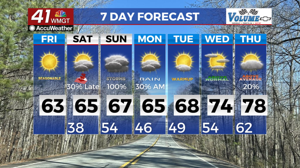
Dry & warm conditions into Saturday, followed by rain for Sunday
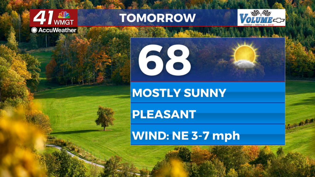
MACON, Georgia (41NBC/WMGT) – A Fire Danger Statement is in effect for Friday areawide. Relative Humidity values are expected to drop into the 20s during the afternoon and evening. 


 Northwest flow in the upper levels dominates the eastern half of the U.S. with ridging situated across the western states. A subtle feature within the flow acts to increase mid and high level clouds early on Friday but otherwise dry conditions are on tap. At the surface, the high pressure ridge centered over the Ohio Valley early Friday will slide southeast and center off the Carolina coast by early Saturday. This will act to bring winds around to the east and southeast by Saturday, resulting in a gradual increase in moisture ahead of an approaching system for late Saturday into Sunday. High temperatures will continue to run above normal by about 4 to 6 degrees into Saturday. With low dewpoints, overnight lows will still be cool and in the 30s to 40s which is closer to normal for this time of the year. The extended forecast begins with high pressure centered off the Carolina coast keeping Georgia in moist southerly flow ahead of the incoming frontal system. By daybreak Saturday, the closed low system is expected to be centered over the Texas panhandle as it moves east into the Mid to Lower Mississippi River Valley through Saturday night. A deep layer of moisture out ahead of the low pushes into North and West Georgia Saturday evening with precipitation spreading across the state through Sunday morning. Instability with this system stays weak especially Saturday night so only showers are in the forecast. Things begin to heat up and become a tad more unstable Sunday however, it’s not too bad. Sunday afternoon temperatures rise into the 60s and lower 70s so minimal ingredients for thunderstorm activity will lessen. An isolated strong storm cannot be ruled out, but the threat for severe weather remains low at this time.