


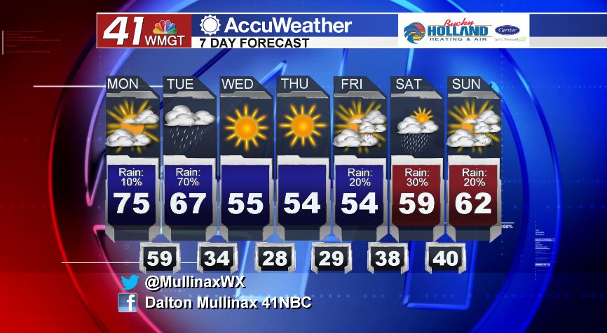
Dry today before rain and storm chances increase tomorrow morning
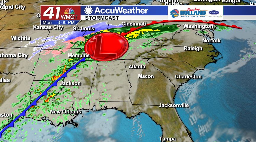
MACON, Georgia. (41NBC/WMGT) – It will be a warm and muggy start to the work week ahead of a dynamic storm system that will bring showers and storms, a few storms being on the stronger side, to Middle Georgia tomorrow.
TODAY.
Under a partly sunny sky this afternoon, temperatures will be topping out in the middle 70’s as a southerly wind will drive warmer and more moist air into our area. It is going to feel more like a spring afternoon rather than a middle of December day. Clouds will continue to increase throughout the afternoon and evening which will set us up for a mostly cloudy sky tonight and temperatures in the upper 50’s and low 60’s.
TOMORROW.
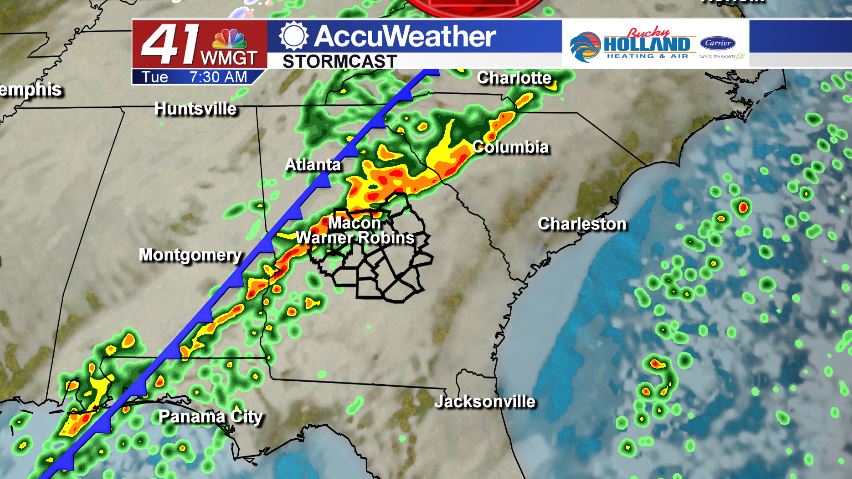
We start off the morning with a cold front moving through the area. By daybreak tomorrow morning, showers and storms will be scattered along and just ahead of the cold front. Some of the storms with this system could be strong to potentially severe. The main storm threats are damaging wind gusts of 40 to 60 mph and heavy rainfall, but a brief spin-up tornado cannot be ruled out as well. We will continue to monitor this system as it evolves.
Once the front clears Middle Georgia, we will see temperatures falling throughout the afternoon. After lunchtime, temperatures will be falling through the 50’s under a partly cloudy sky.
EXTENDED FORECAST.
We dry out and cool off on Wednesday and that will continue through the end of the week. Temperatures during the afternoon will top out in the middle 50’s after we start the mornings off in the upper 20’s and low 30’s.
Follow Meteorologist Dalton Mullinax on Facebook (Dalton Mullinax 41NBC) and Twitter (@MullinaxWX) for weather updates throughout the day. You can also watch his forecasts Monday through Friday on 41NBC News at Daybreak (6-7 a.m.) and 41Today (11 a.m.)

Leave a Reply