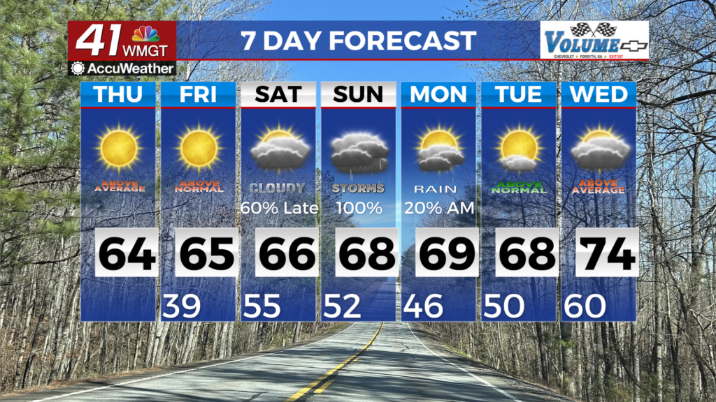
Dry today but showers on tap for late Thursday
MACON, Georgia (41NBC/WMGT) – Expect scattered rain showers and thunderstorms to return to Middle Georgia on Thursday as the next upper level trough deepens over the Eastern U.S. 
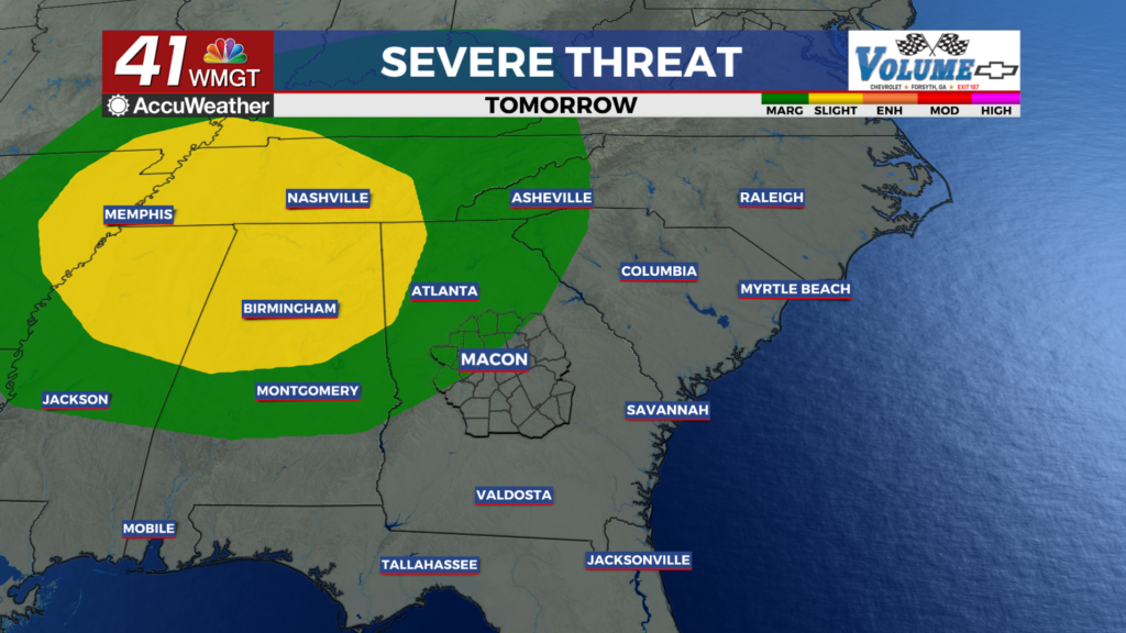
 Models are favoring northern Georgia for the highest rainfall chances due to moisture availability and proximity to the trough. If dewpoints rise into the mid 50s, some instability may be likely but not probable. At this time, the favored storm model looks to be isolated cells or small bowing segments, in which hail or damaging winds would be the main concerns. The Storm Prediction Center has highlighted this risk by placing Northwest Georgia in a Marginal Risk (level 1 of 5) for severe weather. The potential for storms of any kind should decrease quickly as you move south into central and southern Georgia. Breezy northwest winds behind the passage of the cold front will usher in cooler temperatures on Friday.