


Dry for another day before showers arrive for Friday
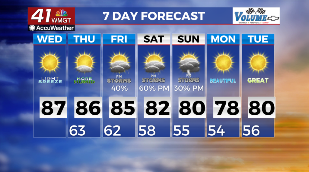
MACON, Georgia (41NBC/WMGT) – A Bermuda high centered off the Carolina coast is keeping moist easterly flow and few clouds over our area. With a few boundaries over the region, 
 this high pressure ridge will keep most locations dry. The ridge is expected to weaken and we should see isolated showers and thunderstorms across north and west Georgia Wednesday. We are not expecting any severe storms at this time. Temperatures Wednesday will be in the mid to upper 80s. Lows tonight will be mainly in the 60s. For Friday, moisture increases across the area ahead of a cold front, leading to increased rain chances. This front will make progress towards the southeast on Friday as an upper wave swings from the Upper Midwest into the Great Lakes. The trend has been for systems to slow down in their progression leading to more extended time frame for shower and thunderstorm potential. Coverage will be the highest across the northwest half of the area on Friday with daytime enhanced convective coverage peaking during the afternoon and evening. Drier air is more likely to filter into parts of north Georgia on Sunday behind the front. Lows will be more pleasant, mainly in the 50s, and highs will be in the upper 70s to lower 80s.