


Dry and cool end to work week
MACON, Georgia. (41NBC/WMGT) – We are going to be dealing with dry and cool conditions over the next couple of days before rain returns to Middle Georgia this weekend.
TODAY AND TOMORROW.
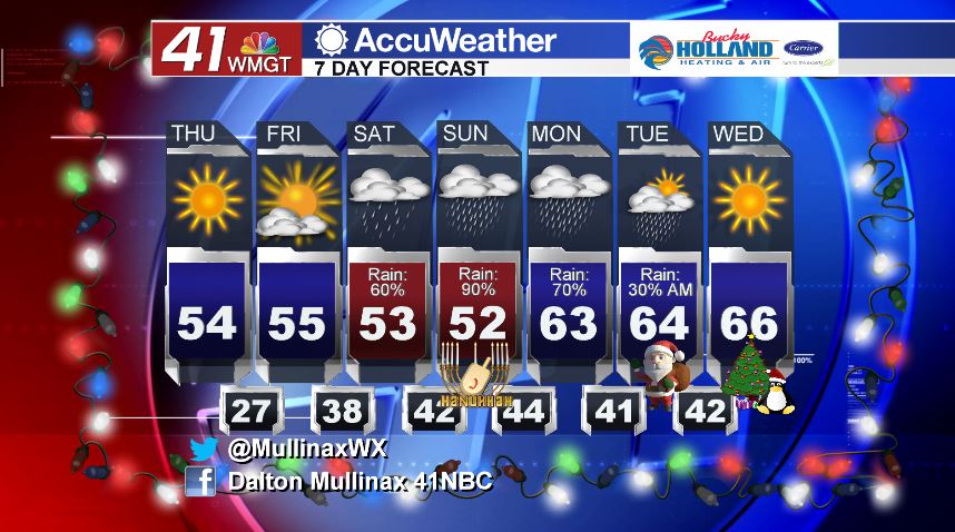
Under a mostly sunny sky this afternoon, temperatures will be topping out in the low to middle 50’s once again. With a clear sky expected overnight, temperatures will quickly fall after sunset. By daybreak tomorrow morning, lows will be in the upper 20’s and lower 30’s all across the area. We stay dry for Friday, but cloud cover will begin to increase across the area late in the day. Temperatures during the afternoon will warm into the middle 50’s before falling into the middle and upper 30’s overnight.
WEEKEND.
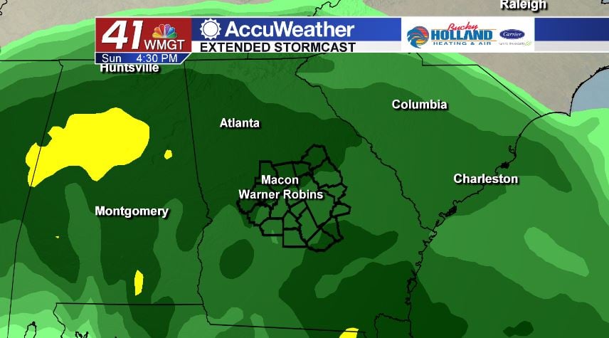
We start out Saturday with a mostly cloudy sky and a few isolated showers. A wedge pattern sets up just in time for the weekend so that means we will be dealing with cool air on both days. High temperatures will top out in the upper 40’s and low 50’s. By Saturday night, rain coverage and intensity will be on the rise as a low pressure system moves out of the Gulf of Mexico, sending plenty of moisture for showers our way.
EXTENDED FORECAST.
Rain is expected to hang around on Monday and for the morning hours on Christmas Eve, but by Christmas day we are looking at a partly sunny sky with temperatures in the middle 60’s.
Follow Meteorologist Dalton Mullinax on Facebook (Dalton Mullinax 41NBC) and Twitter (@MullinaxWX) for weather updates throughout the day. You can also watch his forecasts Monday through Friday on 41NBC News at Daybreak (6-7 a.m.) and 41Today (11 a.m.)

Leave a Reply