


Dry conditions start off the new week; showers return midweek
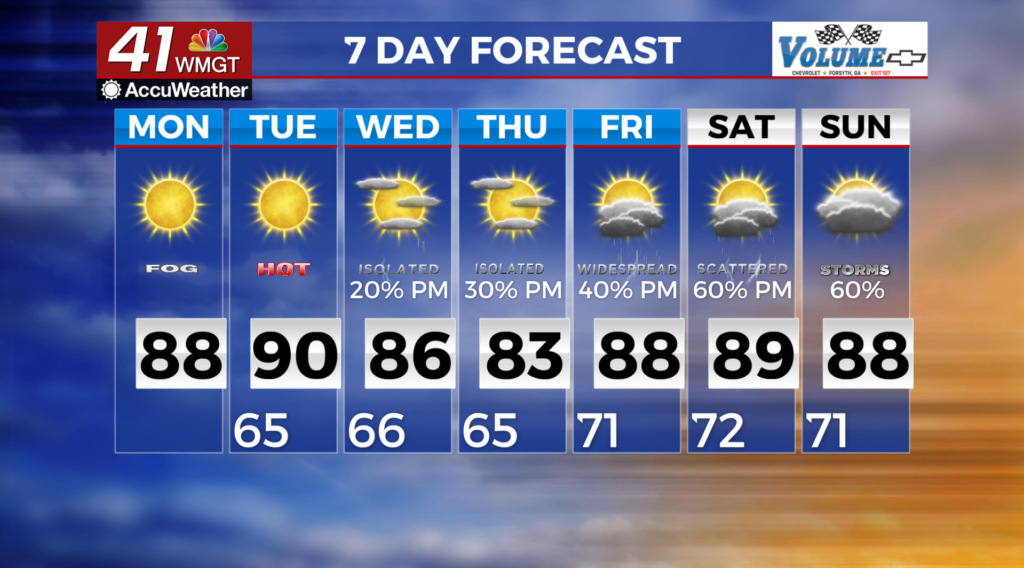
MACON, Georgia (41NBC/WMGT) – Dry conditions will continue through Tuesday. A mid-level ridge builds across the eastern portion of the region. Expect sunny days and clear nights with just 
 a touch of fair weather cumulus clouds. Low temperatures will be in the upper 50s to mid 60s this morning and Tuesday morning. High temperatures both days will be in the mid 80s to lower 90s. These temperatures are within a few degrees of normal for this time of the year. Smoke from the wildfires from Canada will be in the upper levels of the atmosphere over the state today and tomorrow. The smoke while becoming more dispersed or less widespread in coverage will likely remain entrained in the upper level flow, in the absence of any dramatic changes in the pattern. Expect wetter weather by mid to late week as high pressure exits the area and a trough/cutoff low over Florida begins to migrate northward by Wednesday into Thursday. This will bring isolated shower and thunderstorm chances to our southern counties and scattered convection spreading farther north by Thursday. Rain chances look to begin to increase by Friday into the weekend as a midlevel trough pushes a cold front towards the Southeast.