

Dry air slips south into Middle Georgia following cold front
MACON, Georgia. (41NBC/WMGT) – A cold front is finally making its way into Middle Georgia bringing drier air into the south.
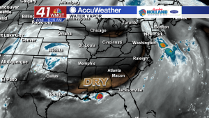
Wednesday morning, satellite imagery on the water vapor channel (showing moisture content in the atmosphere) showed a swath of dry air extending into the Deep South.
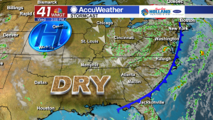
Behind the cold front, a high pressure system will build up across the mid-west.
This high pressure system will cause cooler and drier air to flow into Middle Georgia from the northwest. It will be breezy Wednesday afternoon as winds could gust up to 15 mph.
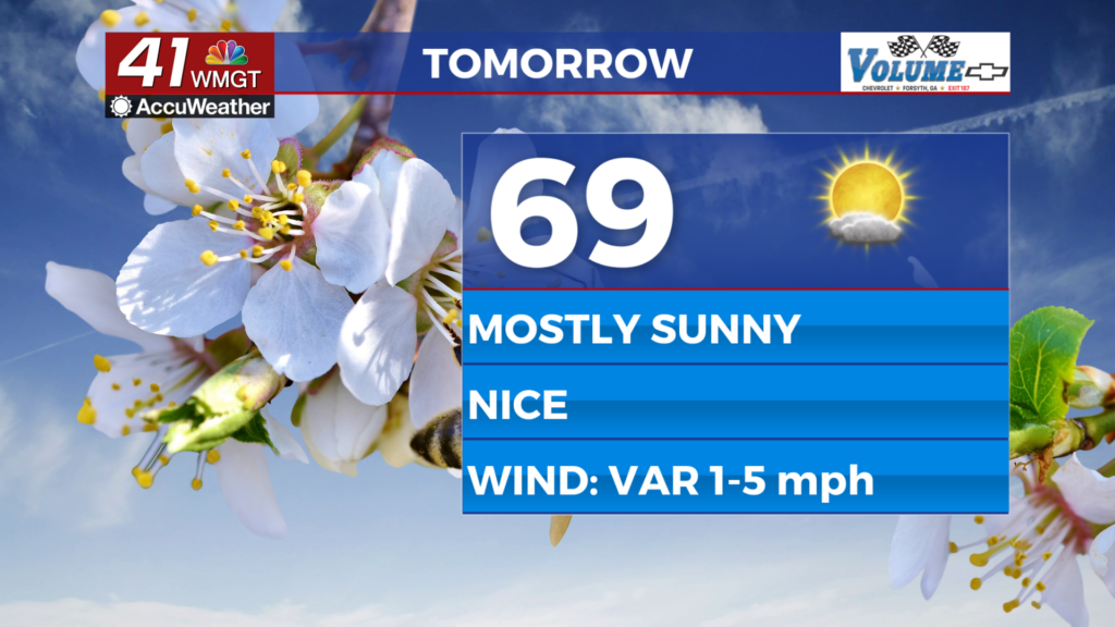
The high will also help clear out cloud cover revealing more sunshine in the sky over the next few days.
You’ll notice the drier air when you step outside, because it won’t feel so humid.
Dew points will drop from the 70’s Wednesday morning to the middle 60’s Thursday.
While Wednesday morning will be muggy, it will feel more comfortable in the next 24-48 hours.

The break in humidity will last for a few days before another moisture-rich pattern returns to Middle Georgia.
Rain chances and temperatures will rise heading into the weekend.
 Connect with Meteorologist Kristen Kennedy on Facebook and Twitter for weather updates throughout the day. You can also watch her forecasts Monday through Friday on 41NBC News at Daybreak (5-7 a.m.) and 41Today (11 a.m.).
Leave a Reply