Drier, warmer weather on tap for the weekend
MACON, Georgia. (41NBC/WMGT)- Rain and storm chances will be more isolated in the coming days as temperatures really crank up.
TONIGHT.

Expect showers to dissipate before midnight. Temperatures will fall into the low and middle 70’s under a partly cloudy sky. Patchy fog during the morning hours is possible Friday. Allow yourself some extra time to get to your morning destination as patchy dense fog could play a role in your commute. If you encounter fog make sure to slow down and use your low beam headlights.
TOMORROW.

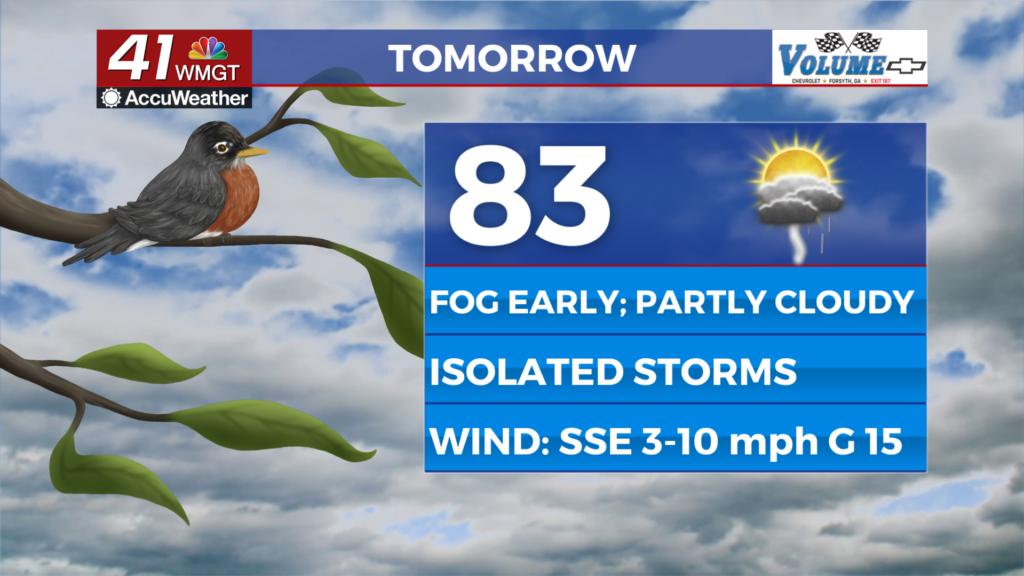
More sunshine Friday means warmer temperatures. Highs will warm into low and middle 90’s as heat index values will approach the triple digits. If you have to be outside tomorrow make sure you are staying hydrated and taking frequent breaks. A few showers and storms are possible tomorrow, but most will stay dry. Friday evening plans look great! It’ll be steamy as temperatures will be in the 70’s and 80’s.
WEEKEND & BEYOND.

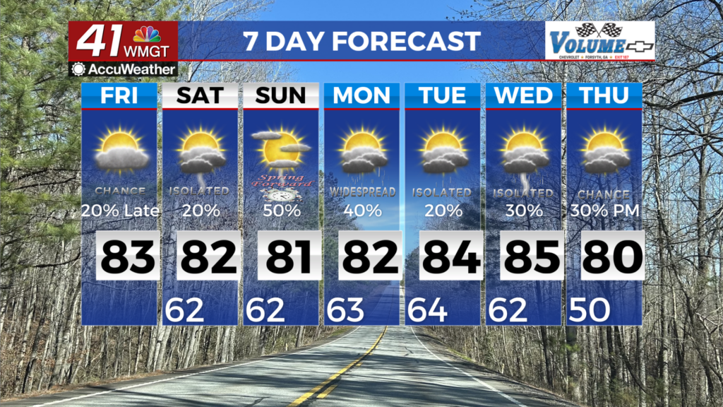
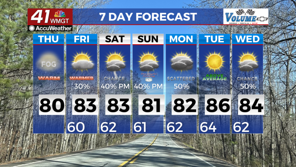
A mostly dry weekend is in store with the exception of a few isolated downpours Saturday afternoon. Temperatures will climb into the middle 90’s by Saturday and will stay there through early next week. We will stay mostly dry through Monday before scattered showers and storms return to the forecast on Tuesday.

Follow Meteorologist Dalton Mullinax on Facebook (Dalton Mullinax 41NBC) and Twitter (@MullinaxWX) for weather updates throughout the day. Also, you can watch his forecasts Monday through Friday on 41NBC News at Daybreak (6-7 a.m.) and 41Today (11 a.m).

Leave a Reply