
Drier days are on the way…just not for long
It has been another stormy afternoon across Middle Georgia, and we are not out of the woods quite yet.
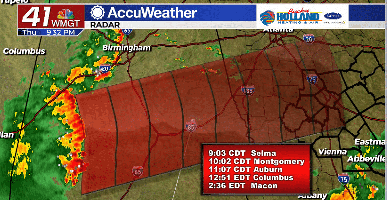
A last round of storms is moving through Alabama and if it holds together could impact Middle Georgia by 1 am. These storms have a history of strong winds and frequent lightning.
Based on the current speed, these storms will likely move through Macon sometime after 2 am.
The storms from today were sparked on a frontal boundary that has mostly stalled out. This boundary begins to work further north tomorrow and will take the bulk of our storm chances with it.
Without the rain temps will warm back into the upper 80’s and low 90’s by the afternoon.
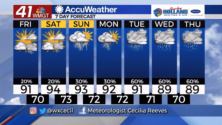
The weekend will bring a more summer-like pattern with heat and scattered showers and storms. Highs will warm into the mid 90’s with high humidity sticking around.
By next week a wetter pattern begins to build in across the southeast. Still quite a few question marks with this system, but expect a pretty rain week on the way.


Leave a Reply